Monday, 8 September 2014

Day Three CT7/G4OBK Algarve SOTA: AL-006 - AL-002 - BT-001

Day Three: 6th September 2014

CT/AL-006 Serra da Salir QRV 1046z - 1145z

XYL Judy arriving on the summit of Serra da Salir


6 Km west of AL-007 Rocha da Penna (which I activated the previous day) is the AL-006 Serra da Salir. 

We drove to Salir and then took a rural road north to a road junction, parking on some rough land opposite a steep uphill earth track to the summit.  We walked 700m to reach the trig point in less than 20 minutes - the ascent was less than 200m. 

Operating on Serra da Salir AL-006
The huge trig point had steps fixed to the side and a pole integral with the top so there was no need to use a fishing pole to support the inverted vee. 

View over the town of Salir
Propagation was good and the weather was settled so an hour was spent on the air. I started on the 30m band and then worked up to 20m, finishing off on the 17m band before I closed down. 

Band - Mode (QSOs): 30m CW (8) 20m CW (24) 20m SSB (22) 17m CW (10) 17m SSB (7)
Total contacts: 71                           S2S QSOs = 3

Distance walked: 1400m with 190m ascent (both ways)

CT/AL-002 Serra do Caldeirao QRV 1336z - 1404z

After leaving Serra da Salir we went into Salir and found a cafe for some refreshments and then headed east to meet the main N2 old road which goes through the mountains eventually reaching Lisbon. The summit plateau is shown as Pelados on maps. I drove across it before I turned back to find a suitable operating position off the road that was away from several antenna installations and overhead power lines. This was where I ended up 50m off the road:


There was a fair amount of passing traffic and a few drivers blew their horns and gave me a wave as they passed, friendly people the Portuguese... Propagation was dissapointing - the HF bands had the "middle of the day blues" it seemed, so no pile ups and only 20 contacts resulted on all three bands used - 30/20/17m in both modes. The high point was working my friends Barry M0IML/P and Alan G4VPX/P on the highest English Mountain - Scafell Pike. Then Heinz HB9BCB/P was worked on HB/BE-102. 

CT/AL-002 - a "drive on" activation in the Algarve
I was wasting time calling CQ to no avail on 17 metres so after five short fruitless calls (that is usually my limit once I know I have been spotted on SOTAWatch) I packed up to head for the Baixo Alentejo Region and CT/BT-001 Serra de Mu...

The highest two summits in Algarve are "drive on activations" and so was BT-001, which was a half hours drive away and well worth activating. 

Band - Mode (QSOs): 30m CW (3) 20m CW (3) 20m SSB (9) 17m CW (5) 17m SSB (NIL)
Total contacts: 20                           S2S QSOs = 3

Distance walked: 100m with zero ascent (both ways)

CT/BT-001 Serra de Mu QRV 1505z - 1543z

I enjoyed the drive on the rural back roads to the wind farm with the large watchtower that is Serra de Mu. The Seat Ibiza we had hired was perfectly suited to our needs - it did well over 50 MPG.
The car parking area on CT/BT-001
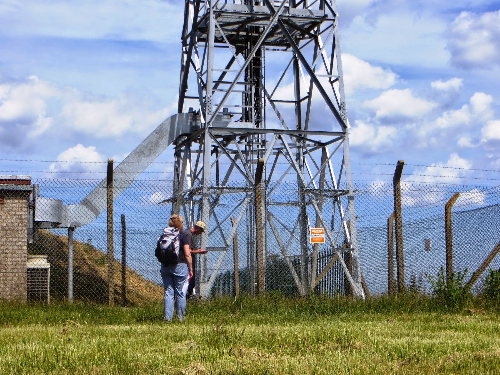
There was a huge watchtower on the other side of the main road from where I parked the car - unfortunately I did not take a photo of that. From the car park I walked up a track for about 200m to the next wind turbine and set up my station beneath it. I know some operators have reported interference when operating in wind farms but so far I haven't experienced any.

CT/BT-001 operating position
Band conditions had now improved and I continued operating in the same vein - starting with Morse on 30m before moving up to the 20m and 17m bands. The same staions were coming back to me on every summit, the most prolific being Terry G0VWP, Roy G4SSH, Don G0RQL and Colin G4UXH (Now SK). I appreciated the following. It seemed that the daily alerts of my activity on the SOTA Reflector and Spots pages were helping progress to a full log book...
 
Band - Mode (QSOs): 30m CW (8) 20m CW (4) 20m SSB (NIL) 17m CW (6) 17m SSB (13)
Total contacts: 31          S2S QSOs = 1 (DH7FK/P DM/NS-170) 

Distance walked: 300m with 10m ascent (both ways)

Day Four CT7/G4OBK Algarve SOTA: AL-003

Day Four: 7th September 2014

CT/AL-003 Serra do Monte Figo QRV 1110Z - 1204Z

My international QSL Card for SOTA Operations
There was one summit activation left to complete the four day mission. We decided to combine this with a sightseeing visit to Tavira, an old town near to the Spanish Border. We used the Motorway part way and then turned off to pass through the towns of Loule and Sao Bras de Alportel - from where the summit could be seen some 7 Km away. The summit was the furthest one from our hotel in Carvoeiro, and had the hire car been collected from Faro airport some 10 Km to the south west of the summit the Serra do Monte Figo would have lent itself to an activation on either our arrival or departure day. This for us was not possible as we had booked a package holiday. This included minibus transfers from Faro to Carvoeiro. Our car was hired for 5 days through Holiday Autos in our resort and was reasonably priced. From experience collecting a car from the airport is generally more expensive. I believe the hire firms factor in the cost of transfer to the hotel into the hire charges... 

I had the benefit again of reading the blog report which Gerald G4OIG had written up on the Summitsbase Website for most of the summits in the Algarve, so I knew that AL-003 was another "drive on" activation. The summit and antenna farm basically was bristling with antennas and transmitter buildings.  Another of the extremely large climbable trig points was also there, which I again used to support my inverted vee link dipole. Sadly the trig point had been defaced with graffiti:

Fishing pole fixed to trigpoint ladder on AL-003 - so the dipole top was at an increased height
The weather stayed fine for the 45 minute operation with the first contact being Summit to Summit to David G3RDQ/P on holiday up north on the summit of G/NP-015 Great Knoutberry Hill in the Yorkshire Dales. This was on 30m CW, a great start to my ninth and final activation in the region. At 1145z I was called on 20m SSB by my friend Terry G0VWP in York who wins the prize for being the only station to make contact with me on all nine summits.


The summit was crammed with antennae - pictures taken on either side of the trig point
I packed up the gear and we headed off to Tevira for our lunch. The hire car was returned the next day undamaged and we reverted to "normal tourist mode" for the remainder of our stay in Portugal. I would certainly return to the country for more SOTA operation, and will be considering visiting the CT/ES Estremadura Region which is near to Lisbon next. I can certainly recommend visiting the Algarve for SOTA, with all summits being easily accessible by car or easily on foot. 

Band - Mode (QSOs): 30m CW (6) 20m CW (10) 20m SSB (7) 17m CW (7) 17m SSB (7)
Total contacts: 37          S2S QSOs = 1 (G3RDQ/P G/NP-015) 

The Vital Statistics of this Tour:

Unique summits activated on Portugal over four days: 9
Total Contacts: 369
Time on air: 6 hours 19 mins (One QSO per minute)
Summit to Summit Contacts: 16
SOTA Completes: 4 already chased out of the 9 activated
Amateur bands used: 10 MHz (30m) - 14 MHz (20m) - 18 MHz (17m) 
CT7/G4OBK/P Phone (SSB) Contacts: 164
CT7/G4OBK/P Morse (CW) Contacts: 205
DXCC Countries worked: 27 (30m 11) (20m 22) (17m 18) Best DX: USA (17m only)

Acknowledgment of information sources and help:

The SOTA Management Team
Gerald's G4OIG Summitsbase reports
DM1CM SOTA Mapping Project
Open Street Map
OSMAND+
Roy CW-G4SSH & Mike SSB-G6TUH  for the greatest help spotting on SOTAWatch

Tuesday, 12 August 2014

SOTA Activations GW/NW-061 Y Golfa & MW-026 Long Mountain August 12 2014

Geoff 2E0NON and I needed two easy summits before heading home on day two of this all too short business / pleasure trip into Mid-Wales. 

GW/MW-026 Long Mountain / Beacon Ring is almost drive on - a short walk from near the transmitter masts took us to a picnic table on the edge of the escarpment... 

G4OBK - my car - was parked up - note the brolly - it looked like rain
We walked to the left of the transmitter site to where we set up the 2m FM station in comfort on the picnic table. GW4TQE/P was worked on GW/NW-049 Gyrn Moelfre.

Here is Geoff logging his 9 contacts on 2m FM - the brolly was not needed after all!
After 15 minutes we packed up and headed to a golf club near Welshpool, not for golf but for more amateur radio... 

GW/NW-061 Y Golfa

We turned right off the A458 at SJ 168065. The name gives the location of this summit away - it lies at the highest point on a golf course and within access land. No need to ask permission then to visit, but if you park in the clubhouse it pays to ask permission for that, which of course we did without problem.  It took just 17 minutes to reach the summit and we were travelling light with just a small 50 watt Yaesu FT1500M Transceiver, half wave vertical dipole and 5m fishing pole.


We ran the station for another 15 minutes and completed 7 contacts with five English Stations and two Welsh ones - notably Alan GW4VPX and Mal GW6OVD/P who was on the summit of Hirfynydd GW/SW-017. 

So that was as much of Wales I could manage for the time being, writing this blog report months later, it was to be January 2015 before I returned to Wales for more SOTA there...

Monday, 11 August 2014

Mid Wales activations 11 August 2014 GW/MW-030 - MW-017

I needed to travel to Welshpool on business in August. My meeting was for just one hour and my travel expenses by car from North Yorkshire were covered, so I extended my visit into a two day trip and combined it with a handful of SOTA activations.  I called my friend Geoff 2E0NON in Malvern to invite him and he agreed to come north and join me for both days. 

Once again I used the booking.com website, finding a pub with a twin room and B&B at an economical rate - this was the The Golden Lion in Llandysilio / Four Crosses, where we stayed for one night. I then set about finding some unique summits in the area which we could easily activate as simply and quickly as possible, using my 40 watt Yaesu FT-1500M 2m FM Transceiver and dipole antenna.

Day 1 Stingwern Hill GW/MW-030 QRV 1058z - 1113z 145 MHz FM - Seven QSOs

Lying just 7 miles south west of Welshpool is Stingwen Hill. Parking was by the gateway at grid ref SJ 131015. The walk to the summit trig point took less than five minutes. If you go there look carefully for a way through the hedge and fence without causing damage - you could be liable. The way up on the left side of the fence is not on a public right of way...

Geoff Fielding 2E0NON was striding out as he approached the summit fence gate and trig point on Stingwern Hill
The weather was perfect for our 2m activation of GW/MW-030, which was completed within 30 minutes including setup / take down, so we were soon on our way to our second summit of Garreg Hir GW/MW-017...

Garreg-Hir GW/MW-017 QRV 1306z - 1315z 145 MHz FM - Five QSOs
A pleasant walk of just 1.2 miles to the summit took us 28 minutes - the return route following the ridge was the better path


Nine miles west of Stingwern Hill is Garreg-Hir. We were parked up, lunched and walking before 1230z. There was parking roadside at SO 012968 shown as Lluast-y-greolen on the OS map.


We went through a gate to follow a bridleway in a nature reserve. With Llyn Mawr below us, it was a walk that my XYL would have appreciated and we had a good day for it, although it was a tad windy as we looked over Llyn Mawr:


Contacts were not too easy, but we qualified with five.....


Top: Geoff fighting the wind.... Below: the writer leaving the access land at the stile grid ref SO 000976

Thursday, 17 July 2014

SOTA Activation G/SC-003 Beacon Batch & G/SC-007 Long Knoll 17 July 2014

G/SC-003 Beacon Batch

An early morning drive south from Bristol took me to the parking spot for G/SC-003 Beacon Batch, at grid reference ST 490580 which is on the B3134 near to the track passing Ellick House. There was room to park under the trees there at the bottom of the track.  The plateau which includes Beacon Batch, is known as Black Down but is not to be confused with the other Marilyn summit called Black Down the highest point in the South Downs National Park, 150 Kms away which is referenced SE-003...

Signage at the parking place roadside under some trees

I was carrying my FT-857 radio, 3S1P 5 Amp battery, 6m Travel Pole and link dipole. The 600m walk took 18 minutes and I was on the summit with little effort. The path was good over a gradual contour... 
G4OBK - My route starting out at 0700am on 17 July 2014
There were plenty of early risers and my friend Roy G4SSH in Scarborough was the first in line at 0641z. At 0726z just before I closed down, VK2UH Andrew in New South Wales was logged on 20m CW. As usual I worked through the callers as fast as I could and made 59 contacts in less than 50 minutes.

Operating from the trig point at Beacon Batch on a grey but mild July morning
Time to get back down then and head to Long Knoll G/SE-007 next, south west of Warminster...

G/SC-007 Long Knoll

There was just room to park my car on the grass at the end of the footpath into Rag Wood at ST 8020 3781. The 20 minute walk to the summit overlooking the Wiltshire Countryside was most enjoyable. There were cows grazing in the area of the trig point when I arrived but they were more interested in eating than bothering me when I went on the air at 1030z...

Selfie - wearing my SOTA Polo Shirt on Long Knoll - taken with the timer on my camera
High route out - low route back....busy road though so my return route is best avoided...

10 MHz was in poor shape and only produced one contact with DL2HWI, but 40m and 20m were pretty good. The last contact logged out of 38 was DX - this was with N1EU, who was the only station outside Europe that I logged in the 45 minutes I was on the air.  Activation complete I chose a different route back. This brought me out further along Frome Road, the B3092. I wouldn't recommend this as a safe walk back and if I visited again I would return back the same way as I went up. 


Tuesday, 15 July 2014

SOTA Activation G/SC-010 Dundry Down 15th July 2014

In the summer of 2014 a relative moved to Westbury on Trym, near Bristol. I now make regular visits to the area, so this means I can easily get to summits in the south of England and South Wales. 

My first visit was in July 2014 and after dinner one evening I drove through the Clifton district of Bristol to a "drive on activation" at the village of Dundry, south of the city. I parked in the British Legion Club Car park but I would have been better driving to grid reference ST 5563 6686 which is within the activation zone. I could have parked and set up there by the fence, instead I went slightly higher and near to some farm buildings where the ground was quite dirty and well trodden by animals. This wasn't access land and I was some distance off the public right of way, but there was no one around apart from the horse who came to see what was going on. Further across the fields were some communications masts. I didn't bother trying to seek out the trig point which was behind the barns and not directly on a public right of way. This was Dundry Down that evening:


The 20m band after 1915z was very disappointing and only one contact was made there with OH3T on CW. The other 39 QSOs were made on 30m and 40m in CW/SSB. 

Watch out for horses! This one came shooting towards me and then veered away as it approached...
The Village Church - the Dundry Inn is just to the right of the junction and has a nice beer garden
There is a historic church and pub in the village which is where I ended up for a swift pint before returning to Westbury on Trym to plan my next two activations further south from Bristol...

Sunday, 22 June 2014

2014 EU Tour Day One - A visit to Botley Hill G/SE-005

Our short walk up Botley Hill
Two of us that's me, Phil G4OBK (Navigator & Co-Driver) and Nick G4OOE (Driver), were heading for the Dover to Dunkirk Ferry on a road trip down to Austria, with a plan to activate SOTA summits in France, Belgium, Luxembourg, and Germany...  ....
 
After leaving North Yorkshire early morning we allowed enough time to reach the parking area for Botley Hill G/SE-005 and activate it on HF.  The TomTom was set to Oxted and took us around the west side of London on the M25.

A short walk with a small ascent from the car park up the Vanguard Way long distance path, brought us to an unusual water tower and a commercial radio mast on the summit. We both set up our individual stations in a field on the top and operated for around 30 minutes - time was short as we had a boat to catch from Dover. 

Nick leaves the designated car park close to Botley Hill - a path goes through some bushes adjacent to the road and comes out at the crossroads where you walk up The Pilgrim Way
The writer at the water tower and mast on Botley Hill G/SE-005
Whilst we were there a couple arrived. It turned out they were members of the RHB Group (Relative Hills of Britain Group) and after surveying the exact location of the highest point they came over for a chat. They seemed impressed that we we were aware we were on a Marilyn summit and that we knew about the 150m prominence that all Marilyns have... We told them a bit about SOTA and what we do before they departed. 

RHB Members surveying the summit of Botley Hill
With 38 contacts completed between us on 20m, 30m and 40m in CW/SSB we packed up and made off to Dover for the boat. By 7.30pm (EU time - one hour later than BST) we were motoring through Belgium on our way to a Bed & Breakfast place called Gastenkamers Offermans in Bierbeek near Leuven - the other side of Brussels. 

Unpacking at our Bed & Breakfast in Bierbeek - recommended
A walk into the village brought us to a fast food Friterie - the Belgian equivalent of a fish and chip shop. We'd had a meal on the DFDS Ferry, however the temptation was too great to resist and we had a "small portion" of chips which turned out to be very large... A short walk then took us into a local pub, serving small beers. Pints were not available, so we had a small one before heading back to the B&B. By this time it was around 11.00 pm so time for bed.
Next day we had planned to activate three Belgian summits, meet up with two Belgian SOTA friends for lunch, and then travel to the highest point in Luxembourg to activate there. 

Link to Day 2 - Belgium & Luxembourg

Saturday, 21 June 2014

2014 EU Tour Day Two - Belgium & Luxembourg

The Gastenkamers village B&B at Bierbeek was superb and we left there at around 7.30am after a lovely breakfast. Our plan for the day was first to activate two Belgian summits and join the SOTA Belgium Association Manager Peter ON4UP with Franz ON9CBQ on the "summit" of ON-010 Baraque Fraiture. We were to activate that summit together after lunch and then motor on down to Luxembourg to LX-001 near Wiltz, where we were booked into a hotel for the night. 

As we left Bierbeek we stopped to view this ornate water tower, before we joined the E40 motorway to Sur Clair Fa ON/ON-011:

Amazing artwork on the Bierbeek Water Tower - Bierbeek is near to Leuven
ON/ON-011 Sur Clair Fa

Most of the Belgian and Luxembourg summits are in the wooded Ardennes region. The walk from the car to the summit on ON-011 took less than 15 minutes after we found a parking place up a woodland track. We both shared my station, after setting up in the woods at a footpath - bridleway crossroads. Our parking place and GPX track can be downloaded from the Sota Mapping Project website. 

A sunny day - Nick operating on ON-011 Sur Clair Fa


We completed 64 contacts on 30m and 40m and then made off to our next summit:

ON/ON-013 Bois de Hodinfosse


My GPS shows where Nick G4OOE parked for ON-013 - again this was up a woodland track, which I located using Open Street Map. Here you see Nick setting up on the "summit":


I operated my own station about 200m away from Nick and we suffered no problem with breakthrough with each of us running 30 watts from Yaesu FT-857 transceivers. With the lions share of contacts being made on the 40m band we decided that for the remaining summits on the tour that Nick would concentrate on the 40m operations and I would fill in gaps in propagation by looking for longer distance contacts on the 30m and 20m bands. The plan worked well.  After less than an hours operation we packed up.  We were meeting out friends Peter ON4UP and Franz ON9CBQ for lunch at an Auberge on the summit of ON/ON-010 Baraque Fraiture and didn't want to be late...

ON/ON-010 Baraque Fraiture

A minor navigational error took us down a country lane on our way to ON-010 but by that time we were close to the summit and being talked in on a 2m handheld by ON4UP, and here we are on the summit (!):


Left to right: Peter ON4UP - Franz ON9CBQ - Phil (Writer) ON/G4OBK - Nick ON/G4OOE

The Auberge is located on a crossroads well within the activation drop zone of 25 metres. After drinks and a Croque Monsieur Peter took us into the woodland on the summit to locate the trig point. Our mission was successful:


We then made our way to our operating positions on a large car park on the opposite side of the main road. This car park gets full in the winter when snow is lying as it serves a ski area. Today we were the only people using it. Between us we activated on the 4m, 2m, 30m and 40m bands before bidding our farewells to our Belgian friends and making for the highest point in Luxembourg, Steekammchen LX/LX-001 which is near to the town of Wiltz where we were staying overnight in a hotel.  

LX/LX-001 Steekammchen

Once again a woodland track (tarmac) took us near to the summit. We drove beyond the highest point and then walked back and across some rough land to an area used for harvesting wood. It was after the end of the working day so there was no one around. I set up by some log piles, and Nick set up about 300m away to avoid interaction between the two stations. 


Operating position among log piles on LX/G4OBK/P on LX-001


Nick sets up his dipole antenna for LX/G4OOE/P on LX-001

We operated for just 30 minutes and we both found conditions disappointing, with 40 contacts between us. We had a slight problem in that Nick had left his Morse key in his car. Whilst monitoring the Rucksack Radio Tool app I noticed a spot from Roy G4SSH saying "Morse key forgotten" against Nicks SSB spot. That was a cue for me once I completed my CW activity to stroll over to Nick's position and loan him my Palm Key...  I finished off five SSB contacts with GM4YMM, EA2CKX, G4ZRP, OE3GGS and DG9WD before going QRT. NIck went on to complete 11 CW QSOs with my Morse key including S2S contacts with HB9BAB/P and DL4FDM/P. 

We then returned to the town of Wiltz and our hotel which was a former Tannery:


After a stroll around town we noticed it was a public holiday and the only place to eat was at our hotel. We returned there for our evening meal after a great day on the road and activating four summits. 

Next day we planned to activate LX/LX-003 before the long drive into the Baden Wuerttemberg (DM/BW) region of Germany - Link to Day 3

All my GPX tracks can be obtained from the SOTA Mapping Project provided by Rob DM1CM.

Friday, 20 June 2014

2014 EU Tour Day Three - Luxembourg & Germany

A drive of less than an hour from our hotel in Wiltz took us to another high woodland in Luxembourg. Now we were near to the German border. We parked inside the activation zone on Kiirchbesch LX/LX-003 and walked along a track into a beech wood.  The two stations were set up alongside the track:

Nick LX/G4OOE/P operating in the wood on the summit of LX-003 Kiirchbesch

Conditions were very good on all three bands (40m, 30m & 20m) with 92 contacts completed between us in less than an hour.


Returning to the car we were soon crossing the German Border and looking for somewhere to eat. We found a garage and transport cafe within a few hours driving time and stopped off for lunch, having the special of the day as seen on this advertising board:


We weren't sure what we were getting, but as we both like Schnitzel we ordered the €8 dish anyway. The meal turned out to be Schnitzel cooked in a pepper sauce and it came with a pile of chips. We were well pleased! 

Moving on we came across several road closures. These Umleitung (German for diversion) signs became a familiar sight. In the UK when road closure diversion signs are erected you can often get through. Not so in Germany - if the sign says Umleitung, it means Umleitung, take the diversion. Towards the end of our day we were travelling through a housing area in Deilingen within 2 Km of our final summit of two on the day, Rainen DM/BW-042. After several failed attempts to get through with lots of arm waving from construction workers we took the long way round.  A track into woodland led us into the activation zone and our stations were set up 100m each side on Nicks car. 

Summit top marker on DM/BW-042 Rainen
We made 57 contacts between us before heading to our accommodation for two nights at the Gasthof Adler in the nearby town of Obernheim. The hotel was cheap and cheerful and mine host was most welcoming. The tariff being €65 per night in a twin room. 

Our plans for the next two days was to activate as many ten point summits in the DM/BW area as we could on our way to Tettnang near the Austrian border.  Nearby Friedrichshafen has a large exhibition centre similar to our Birmingham NEC and hosts the biggest annual ham radio convention in Europe every year over three days in late June. You can liken it to The Motor Show, but this was event is for radio hams, not petrol heads!