Thursday, 24 October 2013

Wales & Borders - October 2013 Trip - Day Two: 3. Gwaunceste MW-010

After leaving Hergest Ridge G/WB-008 by car we were in Wales and on our way up Gwaunceste GW/MW-010 within 30 minutes...

Geoff tries to catch me on our way up Gwaunceste and the well defined route taken
The parking place was on a col near Hill Castle and Three Wells (Farms) at SO 166534, 1 Km east of the hamlet of Glascwm. Gwaunceste Hill is shepherded by Farmer Ernie Bevan, who lives in the nearby farm and who we met after our activation of the summit. An undulating bridleway is followed for 1.5 miles. At SO 155553 we turned right and were soon on the summit of the hill (35 mins). We set up the station at the trig point on the plateau.

The writer on the plateau of Gwaunceste Hill GW/MW-010
Eight stations were logged and Don G0RQL (Near Holsworthy) again made it into the log and was our best DX on 2m FM at 162 Km (101m). We were having a great day in fine weather and were running to time as we made our way back to the car, to be met by Ernie Bevan the local farmer. 

Ernie with Geoff - a meeting up of like minds - Geoff was a farmer earlier on in his life
After putting the world to rights with Ernie we got back in the Subaru and headed north west and further into mid Wales for our fourth activation of the day, Carneddau, MW-023. 

Wales & Borders - October 2013 Trip - Day Two: 4. Carneddau MW-023


Another 30 mins driving time after leaving Gwaunceste and we arrived at Tynyllidiart, marked by a sharp bend on the lane to the north west corner of the access land, which leads through a gate to the summit of MW-023 Carneddau. There was just room to squeeze Geoff's Scooby into the hedge by the gate.
Restricted parking at the road corner at Tynyllidiart
This really was an outstanding short walk (20 mins) around the side of the hill. Good dry land with some sparse heather - easy walking. The summit was featureless but the all round views were exceptional.
Geoff MW6PYG (2W0NON) operating from MW-023 Carneddau
Without any support for my short fishing pole we fashioned one ourselves with our walking poles and some rope. Only six contacts were completed in the 20 minutes we stayed and once again Don G0RQL was logged - over a distance of 157 Km (98 m) this time. We also completed a summit to summit contact with my good friend Jack GW4COX/P on SW-001 Pen-y-Fan. 

Wales & Borders - October 2013 Trip - Day Two: 5. Aberedw Hill MW-022

Geoff follows the fence uphill at SO 093501 - fence is not shown on the latest 2014 OS 1:25000 Map
The route shown on the map is the way we came down from Aberedw Hill. Parking proved awkward on this one so we parked further down the lane on the verge on the edge of the wood at SO 0955 5018. We walked back to the entrance gate to the PRoW at SO 0955 4982. The gate was quite overgrown, but we got through the undergrowth and bramble and as often happens, found a better route on our way down by going through the field gate at SO 0956 5010 which was nearer to our parking place.  After passing through another footpath gate on the PRoW we turned left uphill, to follow a recently erected fence. At the top we followed a path half right. There are many paths and tracks across the plateau of the hill which is access land. 
MW6PYG (2E0NON) operating from Aberedw Hill GW/MW-022
The summit was reached in around 30 minutes from the car and we set up on the knoll at the trig point, which had the centre hole free for the fishing pole. This was our highest scoring summit of the six activations that day with ten contacts on 2m FM using 30 watts and a vertical dipole. Once again Don G0RQL in Devon was the furthest contact at 153 Km (95m).

Returning to the car we were tailed by a couple of Red Kites, once almost extinct.


I lost count of the number of Red Kites we saw in the Welsh Borders and Mid-Wales that day. This bird is one of my favourite raptors and a pleasure to watch soaring in the sky. We were back at the car just after 4.00pm and after turning around in the farmyard at Blaenmilouchaf (farm) set off on the 30 minute drive to GW/MW-025 The Begwns, our sixth and final summit of the day. 

Wales & Borders - October 2013 Trip - Day Two: 6. The Begwns (The Roundabout) MW-025


The Begwns is a piece of upland moorland near to Painscastle in Mid Wales owned by the National Trust. A 15 minute walk from the car took us to the Marilyn summit of GW/MW-025 which provided us with panoramic views towards the Brecon Beacons, where we had been the previous day when we bagged  Ysgyrd Fawr. The view also encompasses the Black Mountains. 

The Roundabout, a millenium project, is a feature at the top. This is a circular dry stone wall which encloses a stand of pine trees and a stone circular seat which is where we are pictured:

Taking a rest at The Begwns MW-025 after our sixth activation of the day
Only five contacts were made from The Begwns. We never heard Don G0RQL, probably on account of the take off to the south. The best DX we could manage therefore was G4TCU in Dudley, a distance of 87 Km or 54 miles.

Setting up at The Begwns MW-025:  Yaesu FT-1500M 30 watts and vertical dipole
It was a fifty mile drive back to Hereford, and the KFC there for some of our favourite (go large) fast food. Job done -  another six unique summits activated in the day.  Tomorrow (Friday) would be a linear road trip for me, with Geoff driving us further north from Malvern to four summits in the Mid Wales and Welsh Borders areas before dropping me off at Church Stretton railway station from where I would return home to North Yorkshire by train. 

Day Two: Six summits - distance walked 12 miles with 2550 ft ascent

Wednesday, 23 October 2013

Wales - October 2013 Trip - Day One: 1. GW/SW-020 Graig Syfyrddin

Late October and I headed down to Malvern to stay with my friend Geoff M6PYG (who became 2E0NON). I caught an early train from Malton and after changing at York and Sheffield and Birmingham I arrived at Malvern Link in the early afternoon. Geoff picked me up from the station and we made off in the direction of Abergavenny on what was fine afternoon. 

A 15 minute walk led to the summit of Graig Syfrddin GW/SW-020

Our first Marilyn target was the summit of GW/SW-020 Graig Syfrddin or Edmund's Tump as it is known in English. We parked at SO 4120 2123 and used a public footpath to lead us to the summit (15 mins). There was a weather station sited here with a large solar panel and a low key cellphone mast. 

Phil & Geoff on the grassy summit of Graig Syfyrddin GW/SW-020
Our 2m FM activation commenced using a half wave vertical dipole antenna and we each made 9 contacts with English and Welsh stations using 30 watts of power from a Yaesu FT-1500M. 

We were back at the car exactly one hour after parking up and heading for our next target of GW/SW-016 Ysgyrd Fawr five miles away.  

Wales - October 2013 Trip - Day One: 2. GW/SW-016 Ysgyrd Fawr


Fifteen minutes after leaving our car park place for SW-020 Graig Syfyrddin we were parked up in a lay-by on the B4521 two miles north east of Abergavenny.

We then set off on the lovely path up to the sandstone hill called Ysgyrd Fawr (The Skirrid) - the most easterly outlyer in the Brecon Beacons. The National Trust bought the 486m high hill and the surrounding  land in 1939. The climb is steep once you enter the woodland but eases up as you approach the summit. It took us 40 minutes to reach the top. 

Once there we set up my VHF 2m transceiver and dipole and completed 11 contacts. The greatest distance worked at 141 Km (88m) was a contact with with Don G0RQL near Holsworthy in Devon. The views were outstanding from the summit as the sun started to set. We left the summit at 5.30 pm and it took 32 minutes to reach the car. 

Phil & Geoff on Ysgyrd Fawr where they operated as GW4OBK/P and MW6PYG/P
We set off back to the English Border for a meal at The Red Lion, a country pub at Stifford's Bridge near to Cradley where Geoff M6PYG / 2E0NON lives.

2 Summits: Distance walked 3.7 miles 1350 ft ascent 

Monday, 21 October 2013

Great Whernside G/NP-008 with Ryedale Walking Group

Route taken Great Whernside from Scar House Reservoir - click for large pic
Eight members of Ryedale Walking Group completed a 12 mile walk over Great Whernside from Scar House Reservoir near Middlesmoor on 20th October.

Jos, Terry, Nick, Steve, Jan, Marcel, Robin at Scar House
The 3 radio ham members Phil G4OBK, Mick G4OOE and Terry G0VWP all made seven brief ham radio contacts on VHF for Summits On The Air from near the trig point (SOTA Ref: G/NP-008). 

The sky was looking ugly on our arrival on Great Whernside
The leader of the group we met on the summit had a sorry tale to tell, one of their group had fallen waist deep into "quicksand" (this was how it was described) on the way up. They said they had got him out....but only just. 

Ryedale Walking Group on the summit
The route passed over mostly access land which was hard going, especially on the return trail following Stone Beck when we tried (unsuccessfully) to locate the wreck of a Wellington Bomber which crashed in 1942. We did encounter a most welcome footbridge at the southern tip of Angram reservoir. Well done to Jos whose sharp eye spotted this through the mist from some distance up the moor - the footbridge (at the weir which is marked) is not shown on the latest 1:25000 OS Map! I think this is because the route around Angram reservoir is a permissive path provided by Yorkshire Water and not a public right of way as such. 

On our way home we called for a drink at The Kings Head Hotel in Masham.  It was a long and adventurous day and we were in need of refreshments - we left Pickering at 8.15am and got home at 8.30pm!

Retiring after the walk in the Kings Head Hotel at Masham

New member Marcel and Terry G0VWP


Everyone said they enjoyed it, despite the inclement weather and uneven ground for walking. We welcomed Marcel on our walk to join our group.  He is a visitor from Holland.

Tuesday, 15 October 2013

My Mum's 87th Birthday Party 15th October 2013

Judy and I went over to Chorley this week - it was my Mum's 87th birthday and so eleven members of our family gathered for a pub meal to celebrate. 

My brother Chris and his partner Sharon got a fantastic cake made for Mum:

My mum's birthday cake - good eh!
My mum served an apprenticeship during World War II, learning her trade as a confectioner. I can't imagine fondant icing was used then or this type of creation even thought of...not with rationing on anyway....

Phil and Mum Barbara - doing well at 87!
It was great celebrating mum's 87th birthday, after she'd had a quite trying year having to move home and all that entails for a senior citizen. Mum's younger than the Queen, but only by a few months.

Thursday, 10 October 2013

A one day Scottish Tour Part 1 - Killyleoch Hill GM/SS-285

Click photo to zoom up

I was staying in a Keswick cottage with my family in early October. On Tuesday 1st October I was released from Grandad duties for the whole day. I left Keswick at 5.45am to head for an area I am familiar with - Dumfries and Galloway.

My first ever SOTA activation took place in the area on Hightown Hill GM/SS-273, in June 2005, and I completed another nine activations in the area in later years, some were indeed first time activations of SOTA summits. 1st October was a special day - the day that Killyleoch Hill GM/SS-285 was entered into the SOTA list of accredited summits with 150m prominence. I wanted to be the first ham to activate the summit, and I was. 

The last time I operated in Scotland was in August 2009 on the fantastic SOTA expedition to Ailsa Craig which was organised by Jimmy M0HGY and Tom M1EYP, great memories of that trip:

Our SOTA Group heading for Ailsa Craig GM/SS-246 in August 2009
Phil G4OBK on Grandad duty the day before - climbing Latrigg LDW-206 for Wainwrights On The Air
This addition to the summits list was the result of a survey completed in August 2013 by Alan Dawson, author and creator of the Marilyn summits book, The Relative Hills of Britain. This summit was activated again five days later by Terry G(M)0VWP.

You can find details of Alan Dawson's survey of the summit and surrounding cols here

Where I parked by the forestry track at NX 8801 8053. I walked through that gate and headed for the summit (40 mins)
A 90 minute drive took me to the chosen parking place for Killyleoch Hill, north of Shawhead. I took Alan Dawsons advice and used the same way up to the summit from the track close to Newtonairds Farm. This was straightforward to negotiate, with three easy dry stane dykes to climb, a few unlocked gates, one locked gate and a small enclosure containing docile highland cattle.

Highland Cattle in small gated enclosure near Loweberry Wood NX 877810
Time taken to get to the wall corner was 40 minutes. I activated against the shelter of the wall in the photo, 75m before the highest point. This was 8m lower than the highest point. 

Operating position SS-285 - the highest point are the rocks 75m in the background
There was a good support for my 6m pole using a convenient fence post in the corner of the wall junction. I operated for 52 minutes on HF CW/SSB and on 2m FM, completing 56 contacts. There were no summit to summit contacts, but I did qualify the summit with 4 x 2m FM QSOs on VHF which was unexpected. The best DX worked was probably YO2BP on 30m CW. 

The writer packed up and about to leave Killyleoch Hill
After returning to the car I set off for my next summit GM/SS-228 Bishop Forest Hill - driving time to reach the parking place there at Marglolly Bridge was a mere 18 minutes. 

If you would like a GPX track of this route it may be downloaded from the SOTA Mapping Project run by Rob DM1CM. 

2.4 miles walked with 520 ft ascent.

Wednesday, 9 October 2013

A one day Scottish Tour Part 2 - Bishop Forest Hill GM/SS-228


Click photo to zoom up
Bishop Forest Hill is a Marilyn summit which lies at the top of the Glenkiln Valley in the Dumfries and Galloway region. The valley contains a sculpture park which was assembled between 1951 and 1976 by the landowner Sir William Keswick. You can find out more about these sculptures on various websites, including Wikipedia. 
SS-228 Parking place in side road near cattle grid at Marglolly Bridge
On my visit to the four summits planned for the day I did not have the time to contemplate these interesting artefacts which are unusually situated in a moorland setting.  I did however see three out of the six sculptures in passing whilst driving up the valley to the parking place for SS-228 at Marglolly Bridge.  I hope to go back again sometime and have a closer look at them.

Looking back down the quad track to Marglolly Bridge
The way to the top was easy - a quad track steep and straight led up the hill across from the bridge, curving left when the climb eased - it was a 25 minute walk for me and I was there, by the big pile of stones and a trig point which had a hole in the top - a perfect fitting for my 6m pole. 

GM/SS-228 Trig point - deep enough to take my 6m long flagpole
A 63 minute session produced one QSO a minute and I finished with 64 contacts of which amazingly, 12 were on 2m FM. The rest were on 40m CW/SSB, 10 MHz CW and 14 MHz CW/SSB. Amongst the contacts were summit to summits with DG0JMB/P, GM4MD/P, EI/G4ASA/P, GW4VPX/P, F6HBI/P and MW0WML/P who all found me on the 40 metre band. 

The summit was activated again five days later by Terry G(M)0VWP.

A misty view down to the 80 acre Glenkiln Reservoir, built in 1934 and operated by Scottish Water
The views could have been excellent but unfortunately mist spoiled the outlook down to the Glenkiln Reservoir. I left the summit at 1115z and made for my next climb at the foot of Bennan SS-224. This was only 10 minutes driving time, less than four miles away by road.   

Time to untie my 3 band link dipole and 2m vertical and head to the next summit - Bennan SS-224
If you would like a GPX track of this route it may be downloaded from the SOTA Mapping Project run by Rob DM1CM.

1.9 miles walked with 600 ft ascent.

Tuesday, 8 October 2013

A one day Scottish Tour Part 3 - Bennan GM/SS-224

Up the moorland to Bennan from west of Glen (Farm)
The GPX track can be download from the SOTA Mapping Project by DM1CM
This was the toughest activation of the day due to the strong wind. The rain shower which had fallen on my short journey from Bishop Forest Hill had finished by the time I reached the roadside parking place at NX 829763, just west of a pink painted farm called Glen. 

Parking place for Bennan GM/SS-224 NX 829763
There was ungated access into the field due to drainage work taking place on the verge. A quad track followed the left side of a small copse. At the top of the copse I kept half right to a gate at 8279 7658 (gate cannot be seen until you are close). The tall structure of Turners monument could be clearly seen on the summit, north west of the gate on Glen Bennan (Not to be confused with the other Bennan (not SOTA)) 16 miles to the west, near Clatteringshaws Lock.

It was rough walking beyond the gate, but not so bad, time taken to reach the top being 22 minutes. The wind was probably around 30 mph and I set up behind the monument for shelter. There was no antenna support and so after a struggle to raise the flag pole it was eventually guyed. 

Monument to John Turner on the summit of Bennan GM/SS-224
I operated for 36 minutes with an excellent QSO rate finishing with 50 contacts. There was a lift on the 2m band to the south and on FM with a simple vertical dipole I doubled the VHF distance expected and completed 11 contacts, the more distance stations being G4ZRP on the Wirral and 2E0XYL in Cheshire. This was unusual. The best DX on HF was VE1WT (Canada) on 20m CW. All HF contacts on Bennan were on CW. 40m SSB was attempted but after calling CQ in different palces without success I did not like the sound of the band, so I quickly gave up in favour of visiting another summit. Twenty minutes later I was in my car turning it round to head back to Shawhead on the way to my last summit of the day See Morris Hill GM/SS-274.

1.4 miles walked with 550 ft ascent. 

Monday, 7 October 2013

A one day Scottish Tour Part 4 - See Morris Hill GM/SS-274

The compact route by road activating 4 summits in Dumfries & Galloway October 1st 2013
A 22 minute drive took me almost right to the top of See Morris Hill SS-274.

Where I parked on See Morris Hill GM/SS-274
On my frequent visits to the area over three decades I have been aware of a prominent tower on a hill overlooking Dumfries. The shape of the tower always looked to me like an oversized Christmas Tree. The overall shape hadn't changed much over the years, although I imagine with changing communications technology the accoutrements fastened to the "Christmas Tree" have. 

The "Xmas" Tree on See Morris Hill 
Research on the hillbagging.co.uk website indicated that non radio ham Marilyn baggers often drive to the gate at the BT compound, which is what I did. Indeed, I was waved on by the farmer from Riddingshill after waiting on the uphill track whilst he herded his beasts into a field. There was an open combination lock metal gate part way up but I took my chance and drove on to park up within 250m of my final operating position by the trig point. The comms site did not appear to be manned as no vehicles apart from mine were present. 

Trig point with centre missing - you couldn't hope for a better support for your pole
I set up at the trig point, which had again the centre removed providing a smart support for my flagpole once I added some padding around it to prevent pole damage. A Berghaus fleece glove was again used for this purpose....   

It was most comfortable on the summit and I had pulled back some time through not having to walk far to the activation point.  After 60 minutes operating time I went QRT with 73 QSOs in my log. The VHF propagation lift experienced on SS-224 Bennan was no more by the time I reached SS-274, but I was satisfied to complete with six stations on 2m FM, the furthest of which was G4UXH, my friend Colin, in Milnthorpe. The other contacts were made on 40m, 30m, 20m CW. Only one station answered my CQ on 14.285 MHz 20m SSB before closing down at 5.00pm. This was S57ILF.

Using a Yaesu FT-857 transceiver I suffered no breakthrough on any of the four amateur bands used, despite the presence of the large commercial installation. 

Job done, with 243 contacts completed in the day, a steady drive via the A75 and M6 took me back to Keswick by 7.00 pm to enjoy a good home made curry dinner and a large glass of red wine to finish of a most satisfying and intense day of Summits On The Air!

A GPX track for GM/SS-274 from leaving the public road near The Grove to the trig point is available from the tracks section of the SOTA Mapping Site - thanks to Rob DM1CM. 

There are many more unique rarely visited summits left for me to visit in Dumfries & Galloway. I'm already planning for my next visit. 

0.2 miles walked with 75 ft ascent.

Sunday, 29 September 2013

An early morning walk up Binsey G/LD-041

Sunday 29th September 2013

A GPX file by MW0WML for this track can be found on the SOTA Mapping Project run by DM1CM
After arriving in Keswick for a family holiday the previous day I ventured out early on Sunday morning on my own to the usual parking place for the 15 minute walk up BInsey. 

The writer enjoying an early morning activation of Binsey G/LD-041
I used a Yaesu FT-1500M FM radio (40 watts) and a vertical dipole mounted on a fishing pole on the 2m 144 MHz VHF to make twelve solid contacts. There was a good path into Northern Ireland (GI), Scotland (GM) and the Isle of Man (GD) with stations exchanging 59 reports both ways:


After 30 minutes operation I headed back to Keswick for my breakfast. As I entered the town in the mobile I heard CQ SOTA on 2m FM. I pulled up immediately and logged G4ONL/P and M0JST/P, the two Victors from Northern Ireland. They were activating Cross Fell G/NP-001 on their way back to the ferry. I was pleased to get them in the mobile log from the lowest part of Keswick by the River Greta bridge on Crosthwaite Road. They were obviously getting out very well indeed.  

Saturday, 14 September 2013

Pennine Journey completion - Sedbergh to Settle

Day 21 Wednesday 11 September Sedbergh to Dent
(6.6 miles 600 ft ascent)
 
At last, after over two years, five of us are finally able to complete our final four day section of Wainwright's Pennine Journey.

Jennie - Judy - Yvonne - Phil (Writer of blog) - Geoff, Pennine Journeymen on this section
Here we are on Whernside the following day
We split this four day section into two easy, and two harder walks after deciding to base ourselves for three nights at the George & Dragon Pub in Dent. A combination or three cars and two taxis enabled this, and we returned to the hostelry in Dent each night in our own cars. 

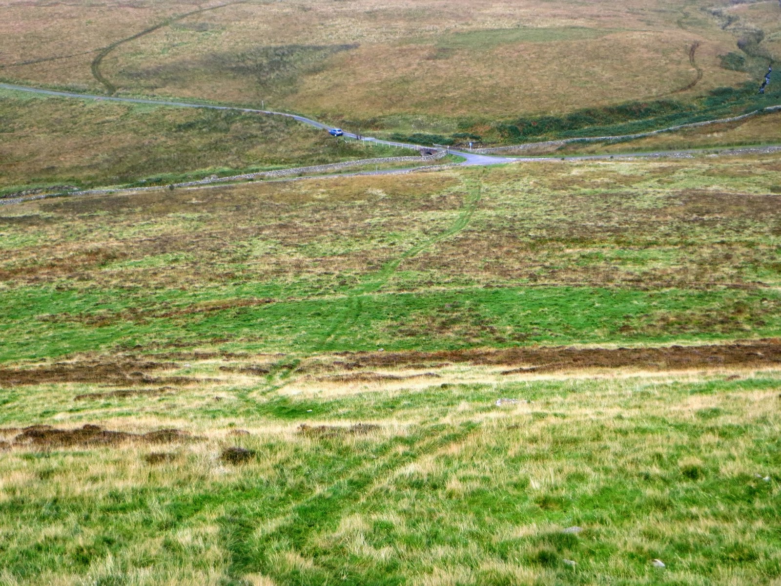
Waymarking of Wainwrights Pennine Journey is now complete
After collecting Yvonne and Jennie at Settle Railway Station where one car was parked for the duration of the walk, we proceeded to Ingleton where my car was left. The five of us continued to Dent in Geoff's car, arriving at 1.00pm. From there we arranged for a Ladycabs Taxi (Tel: 01539 735086) to take us to Sedbergh to restart our walk from New Bridge, just outside the town, where we finished off in July. Our first port of call was lunch, so made for the centre of town to dine in style at Smatt's Duo Cafe Bar & Bistro. 

Sedbergh was quite damp as we departed the town
It was raining as we left the town, but not too heavily as we joined the Dales Way for a straightforward, easy six mile walk to the George & Dragon in Dent where we checked in at 4.00 pm.

A Pennine Journey Waymarker in Millthrop where we joined the Dales Way
We got a great deal on the cost of the accommodation, which was one advantage of staying at the same place for three nights rather than moving on each day, which we had previously done on the Journey. The food at the G&D was on the costly side, however it was of good quality, and we ate there on two out three nights. To be honest, there isn't much choice in Dent if you want a meal.

Day 22 Thursday 12 September Dent to Ingleton
(13.8 miles 2525 ft ascent) Departed Dent: 0925 am


Our plan today was to follow David Pitt's Guidebook and walk to Ingleton, where my car had been parked on the Community Centre car park for two days, by special arrangement with Craven District Council. Parking regulations dictated that the maximum parking period permitted is 23 hours, but the rules were waivered in our case provided two days parking and the overnight fees were paid. 

Leaving Dent at Church Bridge
Wainwright took a short cut in 1938 by using the road through Kingsdale, as his shoes were completely worn out by that time - they were old when he started the walk from Settle anyway, as were his old office clothes. He admitted this in his book suggesting that when paying for his lodgings his landlords took pity on him and charged him less as he looked "poor". He had also run out of handkerchiefs before he got to Hadrian's Wall and his nose still was streaming at this point, as it had from the beginning of the walk! 

So on to our walk....an ascent of Whernside from the west on a route up Whernside which none of us had walked before. The climb was gradual and we joined the Three Peaks Route at a stile 1 Km from the summit. This was my third visit up the hill this year and I suspect my last for some time. The same goes for Ingleborough which we will climb tomorrow. 


Leaving Dentdale
Leaving Dent at Church Bridge we again followed the Dales Way but only as far as Mill Bridge where we turned south. Leaving the public road on Dyke Hole Lane just south of Whernside Manor we climbed up towards a radio mast on the side of Rigg End. The track and route was well pronounced until we reached Boot of the Wold when we turned right on to pathless access land for the most part.

Arten Gill Viaduct at the foot of Great Knoutberry Hill
We followed the dry stone wall until it turned right. Eventually Whernside Tarns appeared abruptly, on the side of Knoutberry Hill at 645m and not to be confused with the slightly higher Great Knoutberry Hill at 672m, located four miles to the north east.
Three Peaks Route footpath improvement work September 2013
On joining the usual Three Peaks route up to the summit of Whernside we came across two workers and a digger who had been contracted to improve the eroded path by flagging it. The chap on the ground told me that they had started work on the Monday of that week and work was progressing very well.  I could see that was right. He told me that the digger had been driven across the moor from the Kingsdale Road - amazing!
The digger at work which came up from Kingsdale
I was bringing up the rear of the group with Jennie, whilst Geoff, Yvonne and Judy had forged ahead. Well before we reached the digger Geoff was already operating his VHF radio by the trig point and making contacts for Summits On The Air. I gave him a call myself when I was around 100m in vertical height from the top to claim my chaser points. At 12.45 pm we both arrived and joined the others in the shelter to eat our lunch, staying for almost 30 minutes.

Ribblehead Viaduct from the flank of Whernside
Army helicopter on manoeuvres around the three peaks  
I had a few more radio contacts myself for SOTA from the summit before we set off on the usual route off the hill south towards Bruntscar. Here again we noticed that the eroded path on the steepest section had been improved since we were last here in May, with more slabs laid. 

When we reached Bruntscar we usually head for either Ribblehead or Chapel-le-Dale, but today on Pennine Journey we went straight on for four miles following a bridleway through Kirkby Gate to Twistleton Scar End.

Phil, Judy, Yvonne, Jennie, Geoff west of Bruntscar
David Pitt's Guidebook mentions a fluted pothole on Page 192. You can't miss it as you pass it by on Ewes Top Moss at grid reference SD 707 764: 


Limestone pavements and a clear path led us to the top of the Ingleton Falls Walk at Beezleys (No charge as it was just after 4.00pm and the attendant must have finished for the day).  We found the steps and undulations hard work after one of the hardest days on the Pennine Journey and reached the town of Ingleton too late (4.50pm) to enjoy cake and tea in one of the café's which were either closed or were closing for the day. 

Huddled on a ledge at the Beezley Falls - Ingleton's Waterfall Walk which dates back to Victorian days
The hardest section of this 4 day leg now completed in good weather, we returned to Dent.

Tomorrow's target - Ingleborough from near to Bruntscar
That evening for a change, we dined in The Sun Inn, Dent. This was quite an experience - no nonsense pub grub served in "the locals local" by a pierced chef with tattoos in abundance. We enjoyed cheap drinks and a landlady who was far from welcoming, but who cheered up towards the end when we were paying.....!!

Day 23 Friday 13 September Ingleton to Clapham
8.85 miles 2300 ft ascent 


The George & Dragon Dent - our base for the last four days walking on Wainwright's Pennine Journey
On our penultimate day we had excellent weather. We motored back to the Community Centre Car Park in Ingleton, driving the longer route through Ribblehead rather than the gated road over the top into Kingsdale. Leaving Ingleton on foot back up the same road led us to Fell Lane, a bridleway which leaves the B6255 on the right just after a milestone. A track leads to a homestead called Crina Bottom and from then the track becomes more of a path.
Pennine Journeymen in the shelter on Ingleborough - the most visited mountain in Yorkshire
I hadn't climbed Ingleborough via this route and it proved to be excellent - and was more gradual an ascent than the march up from the Hill Inn at Chapel le Dale. We followed the same format as on the previous day with Geoff arriving on summit 30 minutes before Jennie and me.  After lunch in the shelter we headed down over Little Ingleborough to Gaping Gill and then on to Clapham. 

Looking into Gaping Gill
I knew this section of route having been up this way with my walking group in 2008. Trow Gill is never forgotten - a natural gorge of a few 100 metres long carved out of solid rock before reaching the sanitised footpath near to Ingleborough Cave.

This is Trow Gill just above Ingleborough Cave
After this we turned left to climb up to Long Lane which took us into Clapham. As we passed Thwaite Plantation near to Ingleborough Hall we wondered what the hidden dangers were lurking within the wood.....the most likely thing would be potholes I expect. The landowner clearly doesn't want people rambling in there as can be seen from the notice....

Signage on the fence around Thwaite Plantation
Walking into Clapham meant that we left the Pennine Journey route and used the tunnels close to Ingleborough Hall to reach the village. After enjoying tea and cake in a cafe in Clapham we missed the 3.46pm bus which would have taken us back to Ingleton.... the chap running the Post Office in the village was very helpful and suggested we phone for a taxi, providing us with the phone number for Austwick Taxis (01524 251364). The driver came immediately, enabling the retrieval of my car from Ingleton, which allowed all five of us to return to our base in Dent for our dinner at the George & Dragon. 

Day 24 Saturday 14 September Clapham to Settle
7.7 miles 870 ft ascent 

Our last section, and an easy half day walk to finish off, with lunch planned at Ye Olde Naked Man Cafe in Settle. I wondered if the Naked Rambler had ever paid a visit there? (See my Pennine Journey High Force to Greenhead blog for when we met him on Hadrian's Wall). 

Bound for Settle on our last day of Wainwright's Pennine Journey
Repeating the last section of the route from the previous day we walked down Thwaite Lane to Austwick. The weather had been improving each day and it was a beautiful morning on which to complete our long walk. After a drink break in Austwick we were delighted to see a family of Red Kite flying around the crags above us close to Meddings Barn. Then I photographed a shepherd near Feizor on his quad bike gathering his flock with his dogs :

Approaching Feizor
There were plenty of people out walking the route, you could tell it was Saturday. We joined the Ribble Way near to Settle and made our way into the town via the riverside path. In this blog I have mentioned the various things we have found along the way and today was no different. This time it was alive, as we came across a small, old and smelly distressed dog trapped at a gate on the path wondering where to go, close to the sports ground on the outskirts of Settle.  

A small dog to add to our list of finds
Found dog reunited with owner


All five of us are "doggy people" and so we walked on, carrying the small dog having decided to head for Settle Police Station to ask for advice. Five minutes later we found the lost dogs owner, but were left unsure if she was happy to see it having allowed it to venture so close to the fast flowing River Ribble.... 

Earlier in the day Geoff had announced he was carrying a heavier load than usual as he wanted to celebrate the completion of the Pennine Journey. Champagne! I was grateful he had thought about this as it was not something I had considered as the planner of our long expedition....

We crossed the Ribble, turning into the back streets of Settle which after passing Booths Supermarket (I never knew they had one) led us to the Railway Station. Our first task was to find the blue plate commemorating Alfred Wainwright's Pennine Journey, which we located in the waiting room of the platform on the town centre side of the station. 

A Wainwright = 210 miles..... David Pitt's Guidebook = 247 miles... Our route = 265 miles with 36000 feet of ascent!
So why did we walk an extra 18 miles? The distance and ascent were accurately measured throughout by GPS and copied on to computerised Ordnance Survey Mapping. David Pitt's guide book splits the route into 18 sections but we split the route into 24 sections. In some cases our accommodation was away from the recommended guidebook route, so extra mileage was walked getting to it. The other increase in the stated mileage of 247 miles was due to the occasional navigational error. It happens. We never got lost, just slightly misplaced, but not too often I am glad to say.....

Geoff opens the champagne on Settle Station assisted by Yvonne
After the waiting room emptied and the train departed we got on with celebrating becoming Pennine Journeymen and quaffed the champers:

Jennie, Geoff, Yvonne, Judy and Phil (Writer)
Then our friend Chas arrived with a present for his partner Yvonne. Chas had walked with us for nine days on the Journey but was unable to join us on the rest due to work commitments. 

Chas's present - a personalised T Shirt for Yvonne
The T shirt says it all and harks back to when we walked from Keld to Bowes via Tan Hill in April 2012 in torrential rain and Yvonne's new Paramo jacket failed to keep out the wet. 

Celebration over we made for Ye Olde Naked Man Cafe (or the Bare Bloke as it is also known) for our lunch before returning to Clapham in Yvonne's car, which had been parked in Settle for three days awaiting our arrival. 

My memories of Wainwright's long walk in 1938 will remain with me for ever......