Saturday, 10 October 2015

Blackwood Hill GM/SS-199 and Roan Fell GM/SS-132


Blackwood Hill GM/SS-199

I was on a walking holiday with Ryedale Walking Group staying at Chollerford, near Hexham in early October 2015. I chose to take one day out for SOTA and skipped breakfast early morning on the Saturday, to drive up the road that runs beside Kielder Reservoir and on into the Scottish Borders Region.  I reached Newcastleton at 0745 am and found the Spar shop there had a Kenco coffee-to-go machine. A cappucino and a Crunchie was my breakfast....

Two summits could be comfortably accommodated in early October with the reducing daylight - so from the Spar in Newcastleton I turned the car round and drove to the parking place (NY 514932) near Steele Road for Blackwood Fell SS-199. This summit had previously been activated just ten times. 

On my way up, via Arnton Fell I avoided the trig point, which is not within the activation zone. I passed it on my way back down as you can see from my map (click to enlarge). This was a steady walk, taking 52 minutes to reach the top, with just one steep section going up to the cairn which is indicated on the map. There were no awkward fences to climb, but it was a little boggy in places between the cairn and the highest point. From past experience it has proved difficult to qualify the more remote summits in the Scottish Borders using FM on the 2m band, so today I was carrying my Yaesu FT-817 and a 3.3 Amp LiPo battery which is now 9 years old and still works well.

Only 15 stations were worked on 40m and 30m - exclusively on CW. I did not have a cellular signal to self spot and my final CQ calls failed to attract any takers on 14062 KHz so I shut down after 26 minutes air time, and made my way to Roan Fell GM/SS-132. 

Roan Fell GM/SS-132

I weighed up my options of what to do next and did consider activating two summits together - this would have been SS-114 Greatmoor Hill and then continuing on to SS-106 Cauldcleuch Head. If I went for these two though it would mean I would have a late return to Chollerford - sometime after 7.00 pm I estimated, so instead I went for the singleton Roan Fell which was across the C Class road from these two summits.  I'll bag those two on another another day. Roan Fell had previously been activated by 8 stations.


It took around half an hour to reach Twislehope where I was to park under some trees between the two farmhouses (NY 447962) at 231m ASL. I wasn't sure of my route - it was reported by Richard G3CWI that he had cycled up to Hartsgarth Fell gate in 2007. The route I took on foot was over the ford. I left the track here though and climbed up over Carlingtooth Rig. From there it was a little tussocky until I reached the track at 453943, but not too bad of a walk. When I reached Hartsgarth Fell gate it became apparent that the shooters track had been laid right over the top of Roan Fell. I climbed the locked gate and very soon reached the highest point of Roan Fell on the track for my activation which was on the 20m, 30m and 40m ham bands. The walk took exactly one hour.
A pile of stones marks the highest point on Roan Fell GM/SS-132
Conditions were better than they were earlier on SS-199 and I was able to self spot my activation on SOTAWatch using the Rucksack Radio Tool app. I made 26 QSOs in 45 minutes with the best DX being with Bob AC1Z in New Hampshire USA and Phil VE1WT in Nova Scotia Canada. 

ON6ZQ Log to Map Conversion showing location of contacts made from SS-132
With time to spare I decided to take a different route back down, once I reached the gate at Hartsgarth Fell.  I took the grassy ridge between Carlintooth Rig and Cockplay Hill down to an interesting place where three watercourses came together (444950). Like my route up there was no path to follow but it wasn't too bad. I soon reached the sheepfold and made my way back to the car after an enjoyable 2nd activation - and I hadn't seen a soul all day. 

Tuesday, 29 September 2015

SOTA Tour to Czech Republic in the Eagle Mountains


I am preparing for my SOTA Tour to the OK/KR Eagle Mountains region on the Polish border, where I hope to activate for four days starting on Friday. This is the first time I have travelled on a SOTA Tour in "minimalist mode" - i.e. with no hold luggage in the aircraft. This saves money and time waiting for the suitcase to arrive on the conveyor belt, and so when I reach Prague I should be able to get to the car hire desk before many other passengers! What will security think of all this gear full of wires and batteries which they do not normally see, as most of it generally goes in the hold suitcase? We will see....

I am travelling via Easyjet on Thursday evening. The good thing about Easyjet is there are no restrictions on the weight of the cabin luggage - only on size. I am carrying everything I need in a Berghaus 38+6 rucksack, which is actually oversize when packed by 9 cms in length. In my pocket I am carrying a small pack up rucksack though, so if Easyjet turn my rucksack away I can just transfer my radio gear to that, which will reduce the height of the rucksack down from 65cms to 56 cms. Then I will have to pay to have the rucksack shipped in the hold. I prefer walking with two poles these days, sadly they aren't allowed in the cabin so none can be taken. I've purchased some plastic tent pegs for my antenna guys should I needed them. I'm leaving the alloy ones I normally use at home as I believe those would also not be allowed.

Here are three pictures of what I am taking - radio gear first, clothing and shoes next and finally the packed rucksack on my back:


Here is my parts list of items inside the rucksack. A few things like camera, GPS, pack-a-rucksack and documents will travel on my person in my walking coat, and I will wear my walking boots and extra clothing when I pass through security: 38+6 Berghaus Freeflow Rucksack Contents: Emergency Pack containing:
Spare Mobile Phone (EE network)
4 spare AA Batteries
Ibuprofen - Paracetamol - Aspirin
Wound dressing
Toilet Paper
Emergency blanket
Plastic Bivvy bag
Compass
Spare boot laces + String
Personal details
Main items: Torch
Yaesu FT-817ND + case + mic + Yaesu FT-270 handheld + whip + spare battery pack
Palm Key + Ultra Pico Keyer + 2 leads + Headphones
Logbook + 4 short pencils + biro
5m Travel pole + guy ring
3Ah LiPo travel battery + lead for FT-817ND
Link dipole 17m-20m-30m + 2 bungees
5 plastic tent pegs - insulation tape - choc blocks
TomTom Satnav and DC lead for car
Asus 10" Tablet
Garmin GPS62s (carried)
Foldaway rucksack (carried)
Small gents umbrella
Canon SX160 Camera (carried)
Mobile phone (Vodaphone network) (carried)
AC Chargers for:
Tablet - Phone - FT-817 - FT-270 - LiPo


Travel Documents: Car Park - Jet 2 flight tickets - Car Hire Voucher - Hotel Vouchers - Passport - Ham Licence - Maps - Czech currency - Message in a bottle personal details - Written Czech / German phrases Clothing etc: 3 pairs under socks + 1 pair hiking socks
2 hankies
2 long sleeve T shirts
1 pair walking trousers
3 pairs underpants
Slip on shoes
Washing kit soap - shampoo - toothpaste - toothbrush - Lynx stick


Size when packed = 65 x 40 x 22 cms (Permitted size for cabin luggage 56 x 45 x 25)

Total Weight = 12 Kgs


Fortunately, all this stuff will not have to be carried around on my tour. I will stay one night (Thursday) in Prague and three nights on the summit of OK/KR-069 at Masaryk Chalet at Serlich 1019m ASL. 
I hope to work many stations using Morse. If I have free time in my schedule I will operate also on 20m SSB in voice if I can. 

Monday, 28 September 2015

SOTA Tour to Czech Republic - in transit

I had no problems getting my oversized rucksack into the Easyjet aircraft at Bristol last week. As usual at security I removed all electrical items - tablet, transceiver, satnav, GPS, camera etc into the boxes provided. The camera, GPS and satnav I was carrying on my person to reduce the size of the rucksack. The liquids such as toothpaste, shampoo and sun lotion were in a clear plastic bag. Once through the scanner I repacked my rucksack which contained all the items I needed for my tour and proceeded to the gate. This process is conducted by agents acting on behalf of Easyjet so the first person I saw employed by them was when I entered the aircraft and was greeted by the air hostess, carrying my slighly oversized (by 10cm) rucksack on my back. Nothing was said and my bag fitted in the overhead locker perfectly, like the normal small suitcases which are used these days as "hand luggage". 

My Easyjet evening flight from Bristol to Prague
The flight took less than two hours and I was soon in the long queue to be photographed by the automated process at Prague airport. It took around 20 mins to get through:

I found my way to the "Rent-a-car" area next and located the Rent+ office where I signed up for my Skoda Citigo 3 door hire car, pre-booked using the excellent Holiday Autos agency, which I always use.  The Skoda had a full tank of petrol. Leaving the airport I used my TomTom Satnav to take me to the Hotel Globus which was around a 30 minute drive on the motorway to the south of Prague. On this journey in the dark (local time around 10pm) the one thing that stood out were the 100s of illuminated large signs advertising various products, such as cars etc dotted alongside the motorway on large gantry's. Something which is strictly controlled in the UK. 

I reached the Hotel Globus in around 30 minutes, here is the text of my review on booking.com:

"Located near the motorway, so excellent for onward early morning travel. An adequate and typical breakfast is served at 7.00am. The hotel and room was scrupiously clean. Room was large, basic but excellent value. Plenty of nearby free parking for my hire car. I also appreciated the late check in. Many hotels on the outskirts of Prague do not offer this". 

I was able to leave the Globus at 7.30am and proceed to the Orlicke Hory in the OK/KR region. This meant using the motorway to reach the city of Hradec Kralove. There were no tolls to pay and the motorway tax permit is provided by the the hire car company automatically. I stopped off in Hradec Kralove at a Lidl Supermarket to purchase sufficient supplies of mineral water, apple juice, fruit and energy bars to keep me going for the four days of my SOTA Tour.  I reached Destne v Orlickych horach (or Destne for short) mid to late morning and made my way to my mountain hostel / hotel called Masarykova Chata on the summit of Serlich OK/KR-069, where I spent the next three nights. I removed the items not needed on my walk from my rucksack and set out for my first of five SOTA summits of the day. Here I am about to set off on foot to my first summit OK/KR-064 Kamenny vrch, on Friday 25th September 2015:

Day One of my OK SOTA tour radio operation and walk to follow...

Sunday, 27 September 2015

SOTA Tour in Czech Republic OK/G4OBK/P Day One

Leaving Masary Chata at 10.30am local time I set off on the gravel tracks of the Eagle Mountains. The 25 kilometre long ridge marks the border between the Czech Republic and Poland.  On this ridge there are 14  summits listed for Summits On The Air (SOTA) and I planned to climb and activate each one over three days. 


A gravel track took me to a hotel at Serlissky Myln from where I climbed a woodland path to join another gravel track, which was a popular cycling route. I reached a bunker and then turned left to walk through woodland right on to the summit of Kamenny vrch, KR-064.

The first bunker seen of the many I passed on my tour
Using an FT-817 and dipole on the 30m and 20m bands I made plenty of contacts around Europe, before heading off to activate Sedlonovský vrch, KR-061. As I was walking an old tractor came towards me on the track. I got a funny look from the tractor driver - presumably this was because I was taking a photo of a Czech tractor....

Soon after this I struck out and went through the wood on my right to the summit of KR-061, which was again in woodland, as most summits in this range are, despite almost all of them being 1000m above sea level. Continuing on my way after activating KR-061 I jumped down a bank to rejoin the track, and fell over ripping the left knee on my walking trousers! A slight graze was all that resulted, and I continued on my way to Polomský kopec KR-068, the summit of which was actually on the track. In this popular area for walking and cycling the waymarking by the authorities is world class, and this signpost to which I fixed my antenna to on KR-068, is typical of many in the region:

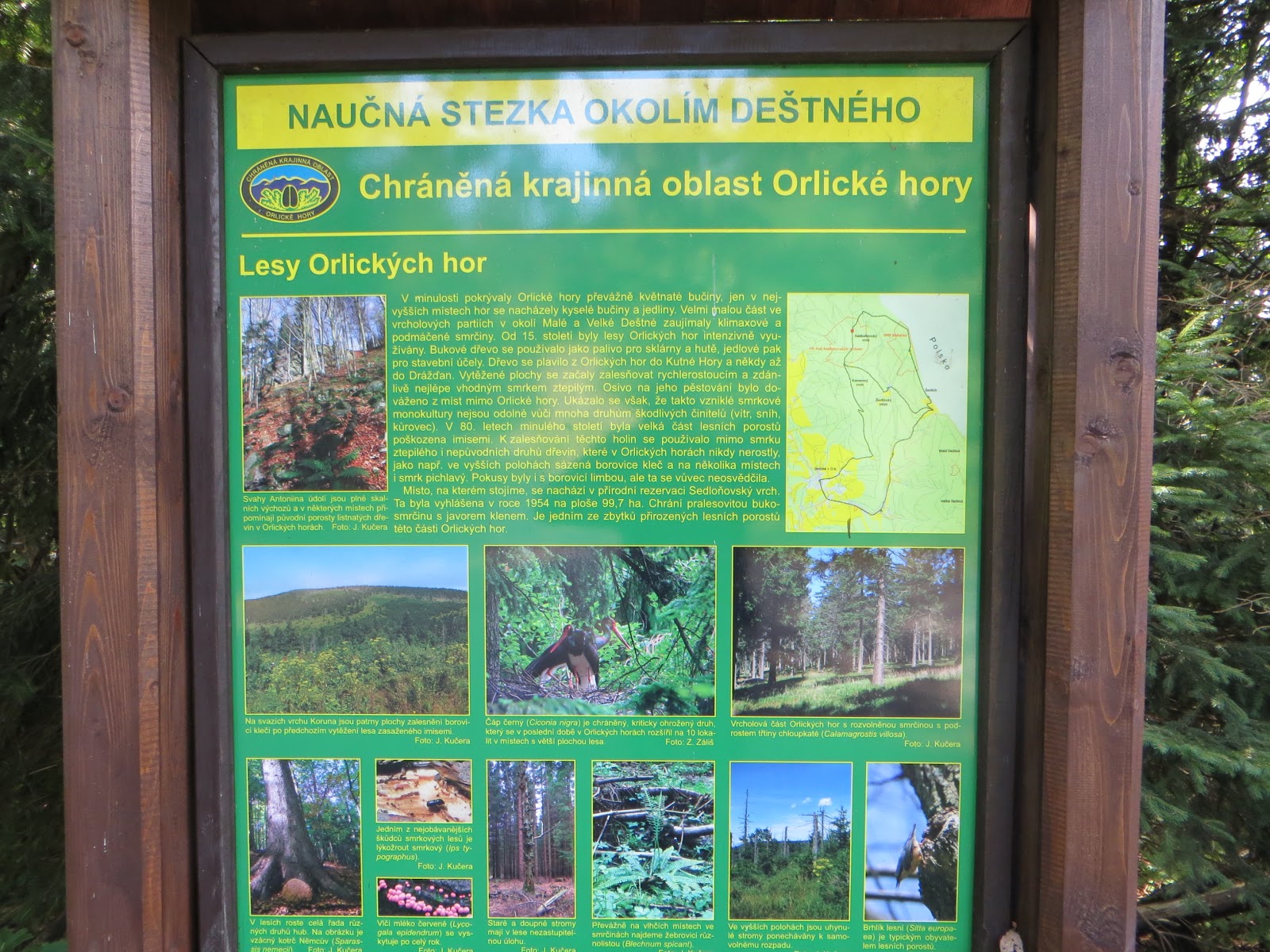
There were plenty of information boards too. A few had an English or German translation, but not this one:

By 3.00pm local time I had reached my 4th ten point summit of the day. This was the 1084m high Vrchmezi reference OK/KR-010, on the Czech - Polish border where there is a three sided marble mounument to famous people and a wooden shelter with table and chairs inside and a large mapboard. Superb facilities and a monument to admire that the Czech authorities should be proud of.


Thirty contacts were logged in Morse and Voice before I set off back towards my hotel lodge, which is within the activation zone for KR-069 Serlich, my final summit activation of the day.  The ridge must catch the snow in the winter - most of the ski runs in the area go down into Poland. I came across some chair lifts prior to finding the trig point for KR-069:


My 5th activation of the day was finished by 5.30pm and I made my way to Masarykova Chata to check in and enjoy some regional food. It had all gone very well indeed. 

Statistics
  • Distance walked / ascent: 7.8 miles / 1300 feet 
  • Summits activated (5): OK/KR-064-061-068-010-069
  • Equipment used: Yaesu FT-817 (5 watts) link dipole 2m FM monitored - no contacts there
  • Points claimed: 50
  • SOTA Complete: 5/5
  • QSOs made on 20m CW/SSB & 30m CW bands: 126
  • Summit to Summit contacts: 7  
More Czech Republic reports to follow... when I find the time to write

Saturday, 26 September 2015

SOTA Tour in Czech Republic OK/G4OBK/P Day Two

Day Two OK/G4OBK Tour: 26th September 2015

I was able to start my breakfast at Masaryk's Cottage just before 8.00am. Czech Republic local time is two hours ahead of UTC time in the summer. My planned linear walk went south over five 10 point SOTA summits from the Masaryk's Cottage on KR-069 on the Orlicke Hory ridge, finishing when I came downhill to the outskirts of the village of Orlicke Zahori. From here I had arranged to be met by Vrata OK1KT and Jan OK2PDT in Vrata's car, when I would be taken back to the Masaryk's Cottage. I left just before 8.30am (0630z) with a packed lunch in my rucksack. 
My 10 mile route on the Orlicke Hory ridge (Eagle Mountains) on the Czech - Polish Border
OK/KR-008 Velka Destna

The first summit crossed was OK/KR-008 Velka Destna, and a tarmac cycle route brought me close to it. There was an information board on the summit and a round shelter built from concrete blocks where I set up my station. As I was operating the summit was visited by several cyclists. The operation followed the same pattern on every summit I visited on the tour. It took around 10 minutes to erect the 5m pole (there was usually something to support the pole with bungees to fasten it), fan out my antenna and to plug up the FT-817 and start operating. I used the Rucksack Radio Tool for spotting which was possible on most summits in the area.


My chosen bands for the whole expedition were 30m (10 MHz) Morse and 20m (14 MHz) Morse / Voice which meant with varying conditions, I was able to log plenty of stations in the UK, mainland Europe and further afield, including USA, Canada and Australia. On average I was making around 25 contacts from each summit - on some summits less and on other summits more, using a simple home made link dipole. On this summit 27 contacts were completed before I moved off on the 40 minute walk to the next 10 point summit of Vresnik OK/KR-060. 
A viewpoint as I leave OK/KR-008 with some of the cyclists in front
Typical section of my walk route to Vresnik OK/KR-060
OK/KR-060 Vresnik

When I reached the highest point on the track at Vresnik I left it and set up the station among some young saplings in an area of the thinned out forestry land. The sun was shining now and it was most pleasant in the outdoors making SOTA contacts on HF. You don't get lonely when activating SOTA on HF with so many friends and ham radio acquaintances keen to make a contact with you... 
A timed selfie shot of me about to leave summit OK/KR-060
After KR-060 I soon left the main track to follow my GPS preplanned route through part of the forest. It was fairly boggy with no real discernable path but I got through quite easily. The previous day I had photographed a military bunker and I again did the same today, however this border line is full of bunkers... I must have passed at least 15 over the three days I spent on the ridge so to save repetition I won't publish the photo of the two I passed on the track between KR-060 and KR-009!
f
OK/KR-009 Orel

This summit lies right on a shooters track, and I set up my station against what appeared to be a military communications hut on the flat topped summit. I found out the next day (when I met Jindra OK1NOR - purely by accident), that this was a Ham Radio Contest Club's Caravan and he belonged to the club! 
Ham Radio Contest Club Caravan at 1099m ASL on the 10 point summit of KR-009 Orel
Operations were becoming quite routine now. Job done I moved off and found a nice place to have my lunch at the bottom of the hill where there was a rustic table and bench by a forest hut.

A nice sheltered place with table and bench to have lunch
OK/KR-070 Homli

On my way to the highest point on Homli KR-070 I passed a comms tower. I then left the track and headed up into the woodland to set up on the highest point where the trees were more sparse. There was nothing worth photographing there, so here is a picture of the tower, which served as a marker for later in the afternoon when I returned there to go down a track which took me to Orlicke Zahori to meet Vrata OK1KT in his car:


After activating Homli I rejoined the cycle / walking path, which was well used. I passed many people, walking and cycling offering them the greeting of "Ahoy" which was the limit of my Czech lanuage skills as I went on my way... 
Following the track now to Tetrovec KR-062 to collect another 10 points
The village of Orlicke Zahori - where I went later on to be met by OK1KT in his car
OK/KR-062 Tetrovec

Among the many people I met on this route there was a walking group of around 10 young people, aged around 30. I passed them as they were picking and eating bilberries. Continuing on for another 500m I reached Tetrovec KR-062 and started to set up my station. The walking group arrived and as usually happens, wanted to know what I was doing. The leader had a really good command of English so I was able to explain, and we had an enjoyable discussion about SOTA, amateur radio and walking in the Czech Republic. I was then offered the hospitality of a drink of their home brew - which turned out to be a warming mouthful of Plum Schnapps - to my taste it was very nice!
OK/G4OBK/P enjoys a drink of Schapps with the unknown walking group
As I approached the end of the afternoon I packed the station up in readiness for the next days activity and made my way back to the comms mast I mentioned earlier. Jan OK2PDT had furnished me with a route down the the village, following ski tracks and a ski tow and I was sat by the roadside in Orlicke Zahori by 5.00pm local time awaiting the arrival of Vrata and Jan. This rural road which follows the Polish border, goes to Destne and is on a regular public bus route - a modern coach passed by as I waited. 

Vrata OK1KT and Jan OK2PDT (who I had worked earlier in the day for two "SOTA Completes" - thank you Jan) arrived within 10 minutes, and we returned to Masaryk's Cottage for a tasty Goulash Meal with dumplings and some Czech Beer.

Vrata OK1KT - Jan OK2PDT - Phil G4OBK in Masaryk's Cottage
I was able to thank Jan for his help with my route on the day and for telling me about Masaryk's Cottage where I was staying. The meeting was really enjoyable, we talked about SOTA and I learned a lot about life in the the Czech Republic and how things have changed since the country became free and independent.   Vrata returned home after a few enjoyable hours. He lives over an hour away in Hradec Kralove. Jan was staying some distance away from Destne. 

Day Two Statistics
  • Distance walked / ascent: 10 miles / 1470 feet ascent 2440 feet descent
  • Summits activated (5): OK/KR-008-060-009-070-062
  • Equipment used: Yaesu FT-817 (5 watts) link dipole 2m FM with 1/4 whip
  • Points claimed: 50
  • SOTA Complete: 5 out of 5
  • Contacts made on 20m CW/SSB & 30m CW bands: 130
  • Contacts made on 2m FM: 2 (OK1KT and OK1AYR/P S2S KR-080)
  • Total Summit to Summit contacts in the day: 9  

Friday, 25 September 2015

SOTA Tour in Czech Republic OK/G4OBK/P Day Three

Day Three OK/G4OBK/P Tour 27th September 2015

My plan for day 3 of my tour was to drive south from Masaryk's Cottage through the village of Orlicke Zahori where I finished my round the previous day, and then turn right to climb an asphalt road into the high forest to a location named on the map as Mezivrsi. I could park there and could reach the summit of OK/KR-013 Komari Vrch quickly. After that there were three more summits on a round which could be reached on foot, and I could call in back at the car for my lunch before summit number four. This meant I did not need to carry much food and drink on my walk. If I had time at the end of the day I intended driving elsewhere to activate one or two "singleton" isolated summits. In reality, this turned into a lucrative 6 summit day for me worth a total of 46 SOTA points.

Here is a map courtesy of mapy.cz showing the proximity of the car park to my first summit of Komari Vrch KR-013:


I parked my small Skoda Citigo hire car near the 3111 road symbol on this map below where three of my GPS tracks join up. The car park was empty at 0830 am  but was full of cars when I returned there at 1315 pm for my lunch. It was then that I discovered that this was a Bank Holiday long weekend... 

Sunday's four summits OK/KR-013-063-071-012 followed later by two more isolated summits in late afternoon

OK/KR-013 Komari Vrch 8 points

I mentioned the chain of bunkers in my previous days blog. These were built to defend the country in the build up to World War II but the plan did not work and the area was annexed to the Germans before the start of the war in an attempt to maintain peace - this short term fix did not work and the country was later invaded by Hungary. There was a lot of resistance in the country and the Czech people suffered executions and deprivation.


The bunker on KR-013 with my antenna on it - I didn't translate the graffiti...

Back to the SOTA - OK/KR-013 is on the top of one of these bunkers, now situated in woodland. Like several summits in the Orlicke Hory now, there is no view. I was on the air working Hans PB2T in the Netherlands on CW using the 30m band just after 0700z. I operated for 25 minutes logging 25 stations before moving off to the next summit. Out of the four summits on this round this was the only summit  situated some distance away from a cycle / walking track. 

OK/KR-063 Kunštátská kaple 10 points

I found a track leaving KR-013 in the direction of KR-063 and from this I regained the main cycle track, however I soon lost the main track and bumbled through some woodland before regaining the main track again. I passed more bunkers and a cafe at a crossroads, which indicated to me how popular the area is for outdoor types:

I turned right at the crossroads where the cafe was located (see map) and took the gradual ascent to the chapel which is situated on the summit of OK/KR-063. Here I made myself comfortable, sitting on a bench with my station on a rustic table. Once again Hans PB2T, was the first one of the 27 stations logged:

The Chapel on KR-063

Inside the Chapel

My operating position on KR-063
Returning to the crossroads with the cafe I took a bearing right to proceed on another track to the summit of Zaklety OK/KR-071. 

OK/KR-071 Zaklety 8 points

The track passed over this rather non-descript unispiring summit. I set up the station in trees to avoid being disturbed by curious cyclists and walkers. There were plenty of people passing by and this had cost me time on KR-063 trying to explain what I was doing to people who couldn't speak English! There was nothing to photograph of interest here, but I did make 30 contacts, including a 2m band FM summit to summit with David OK4KOP/P who was on OK/OL-004. I didn't calculate the distance but I was just using a 5 watt handheld and 1/4 whip antenna for this contact.  I left the summit and decided to cut the corner off the track just before the cafe - not recommended - but I got through and joined an asphalt cycle track which took me back to the car park for my lunch, with 26 points bagged. Not a bad mornings work... Here you see the car park full up at 1315 pm:


OK/KR-012 Anesky vrch 8 points

Every man, woman and dog was out today on this independence day holiday. There was also a military exercise taking place en-route to the summit, and a few people had taken to hiring recumbent bicycles. This smiling gentleman had to keep stopping for a rest - it looked like hard work to me as he enjoyed riding his "quickie" (the name on the bike): 

Military vehicles - the exercise was based around a bunker - see next picture

With my SOTA plans I had no time to go inside this well maintained bunker...

The large tower viewpoint on Anesky Vrch OK/KR-012

Proceeding to the summit I noticed that this was also a target place for a family day out for many people. OK/KR-012 was another summit situated on top of a bunker, and a large viewpoint tower had also been built here. This was accessible to the public, although I did not climb this as my time here was spent on the activation and meeting up with another radio ham... This was young Jindra OK1NOR - who told me he was a member of the contest group that used the caravan on the summit of KR-009, which I had visited the day before. Jindra had heard the Morse coming out of my radio (I rarely used headphones when activating unless it is windy) and that was why he came to visit my SOTA station:

OK1NOR Jindra with the writer G4OBK

This was a really interesting meeting purely by chance, and Jindra stayed with me throughout my activation. Then he walked back with me to the car, pushing his bike, before riding it the 25 Kms back to where he lived. Jindra spoke English very well (as many young people in Czech do) and I learnt much about his country and history during our conversation. This was most interesting.

By the time I returned to the car park there was still time to visit two six point summits before nightfall. Jan OK2PDT had told me of a route used to access Spicak KR-072, but before that I drove into Destne and then up the hill to the west towards the summit of KR-075 Ovcar. From the parking place a short walk took me across a field to the activation point adjacent to a wood. 

OK/KR-075 Ovcar 6 points

An 8 minute walk from this parking place, near to the religious monument pictured and beyond an old church, took me to my operating position on the summit:


As I had found on every summit so far, there was something (a small tree in this case) to carefully fix the antenna pole to without causing any damage.

With over 20 contacts logged I packed up and headed for the final summit of the day on the north west side of Destne. I could see Spicak in fact from Ovcar, as it was only two miles away...

OK/KR-072 Spicak 6 points


Within 10 minutes I was parked up beside a cycle / pony track. The downward route (right side on above map) was preferable and this was the track I have loaded into the SOTA Mapping Project.  After crossing a few fields of cut grass I found a track into the wood. As I approached the highest point I left the track and headed into some sparse woodland where I set up my station in the activation zone. The setting up of an HF SOTA station becomes quite onerous and tiresome after doing it six times in a day, but it becomes a delight when you spot your activity, switch on, call CQ and hear the sound of Morse Code coming back at you from so many fellow SOTA enthusiasts....following that with a little phone work to finish off. Here is a shot of my point of activation, within 10m vertical drop of the highest point which was heavily wooded: 


One contact per minute is on par for me, and once I have confirmed that I have been spotted and callers dry up after 3 CQs I either change band, mode or close down.  It was getting dark so after 18 contacts I pulled the plug, packed up and headed into Destne for a meal and drink at the Hotel Alba where WiFi was available. 

Day Two Statistics

  • Distance walked / ascent: 11.7 miles / 1800 feet ascent 
  • Summits activated (6): OK/KR-013-063-071-012-072
  • Equipment used: Yaesu FT-817 (5 watts) link dipole 2m FM with 1/4 whip
  • Points claimed: 46
  • SOTA Complete: 6 out of 6
  • Contacts made on 20m CW/SSB & 30m CW bands: 148
  • Contacts made on 2m FM: 1 OK4KOP/P S2S KR-071 > OL-004
  • DX QSOs: VK5PAS VK2IO (20m SSB) KA1R (20m CW)
  • Total Summit to Summit contacts in the day: 6