Friday 25 October 2013

Wales & Borders - October 2013 Trip - Day Three: 1. Burrow WB-014

Our route off the summit of Burrow back to Hopesay
Friday October 25th 2013

We planned four activations on Day Three of my October 2013 visit to stay with my fell walking pal Geoff M6PYG / 2E0NON in Malvern. The two and a half days were spent driving around and tramping the hills in an area stretching from Abergavenny up to Church Stretton. I needed to bag my last few Welsh Border Marilyns and today I would finish them and hopefully make plenty of SOTA contacts whilst doing it. 

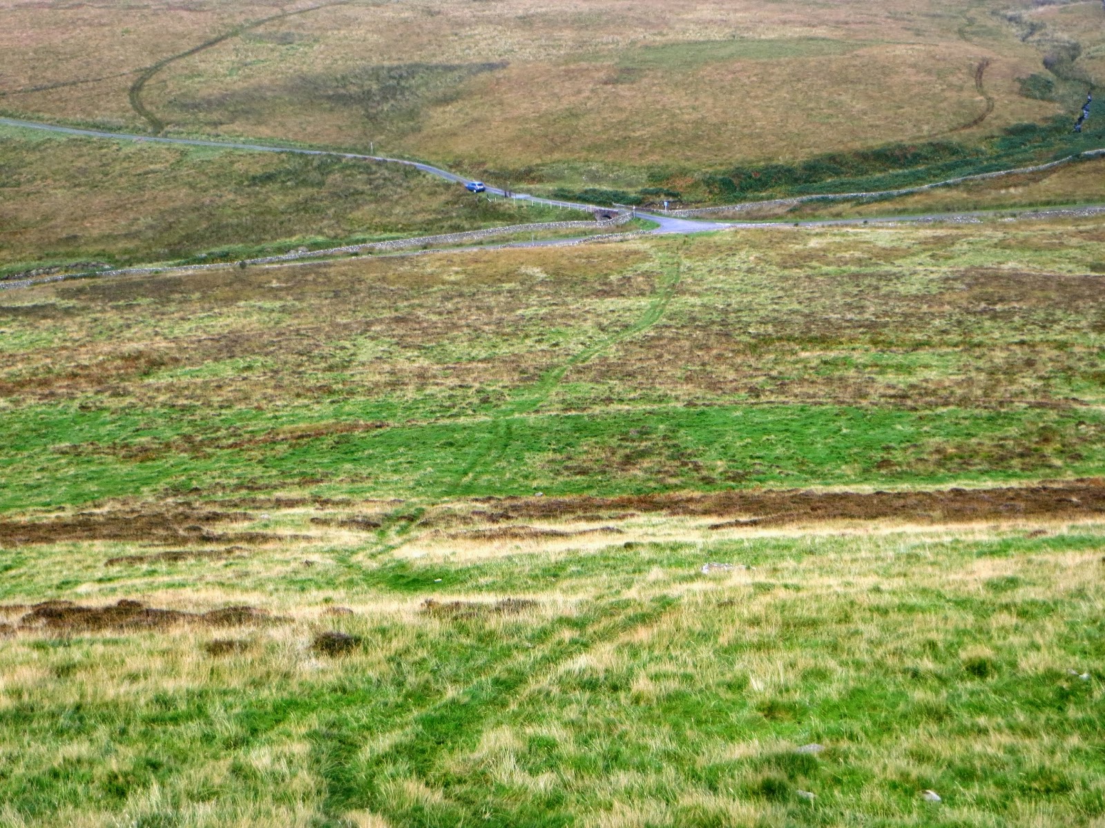
We left Cradley near Malvern with Geoff driving for an hour or so north over the Ridgeway, to Bromyard, Leominster and Ludlow. We left the A49 before we reached Craven Arms to park in Hopesay - our start point for a walk up the Shropshire Way to the summit of Burrow. 

Our chosen route was not the best and we found a much better route down when we discovered a notice stating that the landowner had signed up to an environmental scheme allowing the public to use some of his fields that were not public rights of way.  Walking across this land (picked out on the map above) allowed easier access to the summit of Burrow.  The best way to the highest point is to follow the Shropshire Way to the field corner at SO 3825 8364.  Turn left here and head for the woodland ahead of you. At SO 3821 8337 enter the wood through a gate and turn left to follow the track up to the summit, turning right at SO 3838 8314. The gamekeeper was out feeding the hundreds of pheasants being raised here, and like most gamekeepers from my experience, he wasn't over-friendly shall we say, when he spoke to us briefly.

M6PYG operating on 2m FM in the early morning autumn sunshine on Burrow G/WB-014
The take off from the summit was excellent and we really liked Burrow, this was well managed land and a most pleasant place to be. We were on the air at 0845z working Andy G8MIA in Rugeley, Staffordshire. As on previous days our best DX contact on 2m FM was with the well equipped station of Don G0RQL near Holsworthy, Devon - a distance of 197 Km or 123 miles. We were pleased with the performance of our portable station - a recent use purchase of a Yaesu FT-1500M.  We used 30 watts from a 3 cell LiPO cell. The aerial was a vertical dipole. We made just six contacts before we left to head into Wales to determine if we could hear Don from from the more distant summit of GW/MW-031 Caeliber Isaf. 

Wales & Borders - October 2013 Trip - Day Three: 2. Caeliber Isaf MW-031

Our GPS track from Camp Farm Cottages to the summit of Caeliber Isaf
After leaving Burrow G/WB-014 we made for our only Welsh summit of the day, Caeliber Isaf, (a field top) two miles south of the town of Montgomery in Mid-Wales. Our 40 minute drive took us up a road to a parking area next to some holiday cottages at Camp Farm, where we parked without being approached.

Parking place for our walk up Caeliber Isaf GW/MW-031
Colourful fungi on Caeliber Isaf
We walked down the bridleway with the cottages on our right to a gate. The bridleway went left downhill to some woodland. At SO 2065 9314 as we started to regain some height we left the bridleway and climbed over an awkwardly hung gate. We then followed a fence uphill alongside the wood, before going half right after the next gateway to the highest point of the summit. (15 mins walk from the car).  

We set the station up alongside a fence and enjoyed the best VHF propagation to the north over the three day expedition. We didn't do so well to the south though - and failed to hear regular chaser Don G0RQL from Devon.

The writer and the view from the top field on Caeliber Isaf GW/MW-031
Our best DX to the north was with our good friend WOTA and SOTA enthusiast Colin, G4UXH in Milnthorpe at a distance of 191 Km / 119 miles. We only stayed fifteen minutes and worked six other stations, MW3PZO, M6BLV, M0ZVR, 2E0XYL, G6WRW and G6ODU before returning over the border to England and Heath Mynd G/WB-007.  

Wales & Borders - October 2013 Trip - Day Three: 3. Heath Mynd WB-007

The shortest route up to the summit of Heath Mynd is very straightforward
A 40 minute drive from the mid-Wales summit of Caeliber Isaf (MW-031) brought us to the minor (mostly) metalled road which borders the south west side of Heath Mynd which is completely access land. This was my penultimate Welsh Borders summit - my last one was to follow later in the afternoon when we climbed Caer Caradoc.

Corndon Hill MW-013 on the other side of the Welsh Border - pictured on our ascent of Heath Mynd

We parked on the grass triangle with the information board at SO 329938 and walked the track going NNE to then turn and approach the summit from the north (25 mins to summit). My GPX track can be downloaded from the SOTA Mapping Project Website . We had a great view of Corndon Hill from the top of Heath Mynd. We set up our station by the trig point in a dry stone shelter amongst the heather. 13 contacts were completed on 2m FM with the usual Yaesu FT-1500M supplying 30 watts RF output to the dipole.


Settled in the comfortable shelter on Heath Mynd Phil G4OBK left Geoff M6PYG (2E0NON) right
The weather was still fine when we left the summit at 1.00pm but you could see that rain was not far away. The road surface improved as we departed the parking place to the south to rejoin the A488 at Pitcholds on our way to Church Stretton and Caer Caradoc. 

Wales & Borders - October 2013 Trip - Day Three: 4. Caer Caradoc Hill WB-006

Our route from the car to the top of Caer Caradoc (38 mins)
After leaving Heath Mynd we headed for Church Stretton where I was later to catch a train back to Yorkshire. We bypassed the town and turned right off the A49 a little to the north. A footpath leaves the lane at lower Botvyle but there was no parking here so we drove back almost to the the A49 where there is. Walking back we left the road to walk through a yard - the path is waymarked but the helpful and friendly lady who lives at the last house at Lower Botvyle was happy to point the way. It's certainly a unusual entrance to the public right of way through the yard. After a couple of stiles the path soon heads smartly uphill. The story is told by the contours on the 1:25000 OS Map.... It has been said by some that Corndon Hill is steep, I disagree with this, but Caer Caradoc certainly is, with 900 feet of ascent over a relatively short distance, compared with the nearby Corndon Hill which has less than 500 feet of climbing.   

We reached the top to see that the weather was changing with a storm coming in rapidly from the south. After surveying the whole top, which was most interesting, we hunkered down below some rocks, managing to truss our fishing pole and antenna with the help of some rope.

Geoff's looking happy before the storm as he stays the antenna behind some rocks on Caer Caradoc WB-006
The 15 minute long SOTA operation commenced and we completed 10 contacts with best DX up the Milnthorpe and our friend Colin G4UXH, a distance of 185 Km / 115 miles. Towards our final contacts the hailstorm started, so we hurriedly packed up our comms gear and headed off back down to the hill with too much speed - it would have been fine in the dry but after slipping twice on the lying hailstones I favoured discretion to valour and slowed right down. The hail turn to torrential rain for the last mile back to the car. It was worth the soaking though - this was the last of 23 Welsh Borders Marilyns I had now climbed - the first few were climbed and activated in 2006 when Judy (XYL) and I walked the Mortimer Trail long distance walk from Kington to Ludlow.

The three day operation now complete we headed for Church Stretton where we found a pub.  The barman told us not to sit in the upholstered seats as we looked like a pair of drowned rats! After a swift half pint at 5.00pm the nearby fish and chip cafe opened so we gave them our business, before Geoff drove me to the railway station in time to catch the crowded 17.40pm Cardiff to Manchester Piccadilly train. The connecting train at Manchester to Scarborough was cancelled due to a suicide on the line earlier in the day. This meant when I finally reached York Station at 22.45pm.  It was too late to continue my journey to Malton by train as the last one to Scarborough departed 15 minutes earlier. So along with four other passengers (who were all ladies) a taxi was provided by the rail company to take us to our final destinations....it wasn't such a bad journey after all as the ladies were very chatty and good company.  After getting back home within a few days I was already thinking about a further trip into Wales to climb more Marilyns for Summits On The Air. 

Thursday 24 October 2013

Wales & Borders - October 2013 Trip - Day Two: 1. Bradnor Hill WB-011

Day Two (Thursday) on my sojourn by train down to the Welsh Border area - and an early start in darkness. With six summit activations in England and Wales planned in the day we needed to be up at 5.00am and away before 6.00am so we had maximum use of the daylight. 
We headed north out of Malvern with Geoff driving and yours truly on the maps. Our destination was Kington Golf Course near the Welsh Border where we had an appointment with the "summit" of Bradnor Hill WB-011. The golf course is on access land, so no problem there with us being accused of trespass. Not that there were any golfers - we arrived in the dark and in mist at 07.00 am! We parked at SO 2867 5816 where the dog walkers park. A warning sign there states no vehicle beyond that point. You trek across heathland with gorse in evidence to the highest point on the golf course (391m) where there is a small wooden shed....


Here is Geoff M6PYG (2E0NON) sat in comfort operating on the golf course of Bradnor Hill WB-011. There was a high pressure inversion but no lift conditions and only five stations were worked. We were running 30 watts to a vertical dipole 3m above ground. 

We stayed for 15 minutes and then left to head for our 2nd summit of the day Hergest Ridge WB-008. 

Wales & Borders - October 2013 Trip - Day Two: 2. Hergest Ridge WB-008

Fifteen minutes after leaving Bradnor Hill golf links in Geoff's Subaru we were walking up Offa's Dyke path in mist up to the top of Hergest Ridge.


The 1.8 Km walk from Ridgebourne Road to the summit of Hergest Ridge
Mike Oldfield (Songwriter and Musician) would have appreciated the atmospheric aura we experienced on the 40 minute steady walk up to the stones on the summit.  The mist was coming and going with the temperature inversion taking place around us. This was a most memorable walk just after sunrise, as these photos indicate - our early start was paying us a dividend:

The beauty of the Welsh Borders captured as we made for Hergest Ridge on Offa's Dyke
We looked across the valley towards Bradnor Hill WB-011 a mere 2 Km away
Wild ponies grazing at the Whet Stone 800m from the summit stones

The mist came down and shrouded us on the top - the stones are located at  the highest point
We stayed on the summit for half an hour and completed just six contacts using the usual 2m FM equipment.  Our return to the parking place at the top of Ridgebourne Road (SO 281567) took us 35 minutes and we sped off into Wales to activate Gwaunceste Hill next - SOTA Reference GW/MW-010. 

Wales & Borders - October 2013 Trip - Day Two: 3. Gwaunceste MW-010

After leaving Hergest Ridge G/WB-008 by car we were in Wales and on our way up Gwaunceste GW/MW-010 within 30 minutes...

Geoff tries to catch me on our way up Gwaunceste and the well defined route taken
The parking place was on a col near Hill Castle and Three Wells (Farms) at SO 166534, 1 Km east of the hamlet of Glascwm. Gwaunceste Hill is shepherded by Farmer Ernie Bevan, who lives in the nearby farm and who we met after our activation of the summit. An undulating bridleway is followed for 1.5 miles. At SO 155553 we turned right and were soon on the summit of the hill (35 mins). We set up the station at the trig point on the plateau.

The writer on the plateau of Gwaunceste Hill GW/MW-010
Eight stations were logged and Don G0RQL (Near Holsworthy) again made it into the log and was our best DX on 2m FM at 162 Km (101m). We were having a great day in fine weather and were running to time as we made our way back to the car, to be met by Ernie Bevan the local farmer. 

Ernie with Geoff - a meeting up of like minds - Geoff was a farmer earlier on in his life
After putting the world to rights with Ernie we got back in the Subaru and headed north west and further into mid Wales for our fourth activation of the day, Carneddau, MW-023. 

Wales & Borders - October 2013 Trip - Day Two: 4. Carneddau MW-023


Another 30 mins driving time after leaving Gwaunceste and we arrived at Tynyllidiart, marked by a sharp bend on the lane to the north west corner of the access land, which leads through a gate to the summit of MW-023 Carneddau. There was just room to squeeze Geoff's Scooby into the hedge by the gate.
Restricted parking at the road corner at Tynyllidiart
This really was an outstanding short walk (20 mins) around the side of the hill. Good dry land with some sparse heather - easy walking. The summit was featureless but the all round views were exceptional.
Geoff MW6PYG (2W0NON) operating from MW-023 Carneddau
Without any support for my short fishing pole we fashioned one ourselves with our walking poles and some rope. Only six contacts were completed in the 20 minutes we stayed and once again Don G0RQL was logged - over a distance of 157 Km (98 m) this time. We also completed a summit to summit contact with my good friend Jack GW4COX/P on SW-001 Pen-y-Fan. 

Wales & Borders - October 2013 Trip - Day Two: 5. Aberedw Hill MW-022

Geoff follows the fence uphill at SO 093501 - fence is not shown on the latest 2014 OS 1:25000 Map
The route shown on the map is the way we came down from Aberedw Hill. Parking proved awkward on this one so we parked further down the lane on the verge on the edge of the wood at SO 0955 5018. We walked back to the entrance gate to the PRoW at SO 0955 4982. The gate was quite overgrown, but we got through the undergrowth and bramble and as often happens, found a better route on our way down by going through the field gate at SO 0956 5010 which was nearer to our parking place.  After passing through another footpath gate on the PRoW we turned left uphill, to follow a recently erected fence. At the top we followed a path half right. There are many paths and tracks across the plateau of the hill which is access land. 
MW6PYG (2E0NON) operating from Aberedw Hill GW/MW-022
The summit was reached in around 30 minutes from the car and we set up on the knoll at the trig point, which had the centre hole free for the fishing pole. This was our highest scoring summit of the six activations that day with ten contacts on 2m FM using 30 watts and a vertical dipole. Once again Don G0RQL in Devon was the furthest contact at 153 Km (95m).

Returning to the car we were tailed by a couple of Red Kites, once almost extinct.


I lost count of the number of Red Kites we saw in the Welsh Borders and Mid-Wales that day. This bird is one of my favourite raptors and a pleasure to watch soaring in the sky. We were back at the car just after 4.00pm and after turning around in the farmyard at Blaenmilouchaf (farm) set off on the 30 minute drive to GW/MW-025 The Begwns, our sixth and final summit of the day. 

Wales & Borders - October 2013 Trip - Day Two: 6. The Begwns (The Roundabout) MW-025


The Begwns is a piece of upland moorland near to Painscastle in Mid Wales owned by the National Trust. A 15 minute walk from the car took us to the Marilyn summit of GW/MW-025 which provided us with panoramic views towards the Brecon Beacons, where we had been the previous day when we bagged  Ysgyrd Fawr. The view also encompasses the Black Mountains. 

The Roundabout, a millenium project, is a feature at the top. This is a circular dry stone wall which encloses a stand of pine trees and a stone circular seat which is where we are pictured:

Taking a rest at The Begwns MW-025 after our sixth activation of the day
Only five contacts were made from The Begwns. We never heard Don G0RQL, probably on account of the take off to the south. The best DX we could manage therefore was G4TCU in Dudley, a distance of 87 Km or 54 miles.

Setting up at The Begwns MW-025:  Yaesu FT-1500M 30 watts and vertical dipole
It was a fifty mile drive back to Hereford, and the KFC there for some of our favourite (go large) fast food. Job done -  another six unique summits activated in the day.  Tomorrow (Friday) would be a linear road trip for me, with Geoff driving us further north from Malvern to four summits in the Mid Wales and Welsh Borders areas before dropping me off at Church Stretton railway station from where I would return home to North Yorkshire by train. 

Day Two: Six summits - distance walked 12 miles with 2550 ft ascent

Wednesday 23 October 2013

Wales - October 2013 Trip - Day One: 1. GW/SW-020 Graig Syfyrddin

Late October and I headed down to Malvern to stay with my friend Geoff M6PYG (who became 2E0NON). I caught an early train from Malton and after changing at York and Sheffield and Birmingham I arrived at Malvern Link in the early afternoon. Geoff picked me up from the station and we made off in the direction of Abergavenny on what was fine afternoon. 

A 15 minute walk led to the summit of Graig Syfrddin GW/SW-020

Our first Marilyn target was the summit of GW/SW-020 Graig Syfrddin or Edmund's Tump as it is known in English. We parked at SO 4120 2123 and used a public footpath to lead us to the summit (15 mins). There was a weather station sited here with a large solar panel and a low key cellphone mast. 

Phil & Geoff on the grassy summit of Graig Syfyrddin GW/SW-020
Our 2m FM activation commenced using a half wave vertical dipole antenna and we each made 9 contacts with English and Welsh stations using 30 watts of power from a Yaesu FT-1500M. 

We were back at the car exactly one hour after parking up and heading for our next target of GW/SW-016 Ysgyrd Fawr five miles away.  

Wales - October 2013 Trip - Day One: 2. GW/SW-016 Ysgyrd Fawr


Fifteen minutes after leaving our car park place for SW-020 Graig Syfyrddin we were parked up in a lay-by on the B4521 two miles north east of Abergavenny.

We then set off on the lovely path up to the sandstone hill called Ysgyrd Fawr (The Skirrid) - the most easterly outlyer in the Brecon Beacons. The National Trust bought the 486m high hill and the surrounding  land in 1939. The climb is steep once you enter the woodland but eases up as you approach the summit. It took us 40 minutes to reach the top. 

Once there we set up my VHF 2m transceiver and dipole and completed 11 contacts. The greatest distance worked at 141 Km (88m) was a contact with with Don G0RQL near Holsworthy in Devon. The views were outstanding from the summit as the sun started to set. We left the summit at 5.30 pm and it took 32 minutes to reach the car. 

Phil & Geoff on Ysgyrd Fawr where they operated as GW4OBK/P and MW6PYG/P
We set off back to the English Border for a meal at The Red Lion, a country pub at Stifford's Bridge near to Cradley where Geoff M6PYG / 2E0NON lives.

2 Summits: Distance walked 3.7 miles 1350 ft ascent 

Monday 21 October 2013

Great Whernside G/NP-008 with Ryedale Walking Group

Route taken Great Whernside from Scar House Reservoir - click for large pic
Eight members of Ryedale Walking Group completed a 12 mile walk over Great Whernside from Scar House Reservoir near Middlesmoor on 20th October.

Jos, Terry, Nick, Steve, Jan, Marcel, Robin at Scar House
The 3 radio ham members Phil G4OBK, Mick G4OOE and Terry G0VWP all made seven brief ham radio contacts on VHF for Summits On The Air from near the trig point (SOTA Ref: G/NP-008). 

The sky was looking ugly on our arrival on Great Whernside
The leader of the group we met on the summit had a sorry tale to tell, one of their group had fallen waist deep into "quicksand" (this was how it was described) on the way up. They said they had got him out....but only just. 

Ryedale Walking Group on the summit
The route passed over mostly access land which was hard going, especially on the return trail following Stone Beck when we tried (unsuccessfully) to locate the wreck of a Wellington Bomber which crashed in 1942. We did encounter a most welcome footbridge at the southern tip of Angram reservoir. Well done to Jos whose sharp eye spotted this through the mist from some distance up the moor - the footbridge (at the weir which is marked) is not shown on the latest 1:25000 OS Map! I think this is because the route around Angram reservoir is a permissive path provided by Yorkshire Water and not a public right of way as such. 

On our way home we called for a drink at The Kings Head Hotel in Masham.  It was a long and adventurous day and we were in need of refreshments - we left Pickering at 8.15am and got home at 8.30pm!

Retiring after the walk in the Kings Head Hotel at Masham

New member Marcel and Terry G0VWP


Everyone said they enjoyed it, despite the inclement weather and uneven ground for walking. We welcomed Marcel on our walk to join our group.  He is a visitor from Holland.

Tuesday 15 October 2013

My Mum's 87th Birthday Party 15th October 2013

Judy and I went over to Chorley this week - it was my Mum's 87th birthday and so eleven members of our family gathered for a pub meal to celebrate. 

My brother Chris and his partner Sharon got a fantastic cake made for Mum:

My mum's birthday cake - good eh!
My mum served an apprenticeship during World War II, learning her trade as a confectioner. I can't imagine fondant icing was used then or this type of creation even thought of...not with rationing on anyway....

Phil and Mum Barbara - doing well at 87!
It was great celebrating mum's 87th birthday, after she'd had a quite trying year having to move home and all that entails for a senior citizen. Mum's younger than the Queen, but only by a few months.

Thursday 10 October 2013

A one day Scottish Tour Part 1 - Killyleoch Hill GM/SS-285

Click photo to zoom up

I was staying in a Keswick cottage with my family in early October. On Tuesday 1st October I was released from Grandad duties for the whole day. I left Keswick at 5.45am to head for an area I am familiar with - Dumfries and Galloway.

My first ever SOTA activation took place in the area on Hightown Hill GM/SS-273, in June 2005, and I completed another nine activations in the area in later years, some were indeed first time activations of SOTA summits. 1st October was a special day - the day that Killyleoch Hill GM/SS-285 was entered into the SOTA list of accredited summits with 150m prominence. I wanted to be the first ham to activate the summit, and I was. 

The last time I operated in Scotland was in August 2009 on the fantastic SOTA expedition to Ailsa Craig which was organised by Jimmy M0HGY and Tom M1EYP, great memories of that trip:

Our SOTA Group heading for Ailsa Craig GM/SS-246 in August 2009
Phil G4OBK on Grandad duty the day before - climbing Latrigg LDW-206 for Wainwrights On The Air
This addition to the summits list was the result of a survey completed in August 2013 by Alan Dawson, author and creator of the Marilyn summits book, The Relative Hills of Britain. This summit was activated again five days later by Terry G(M)0VWP.

You can find details of Alan Dawson's survey of the summit and surrounding cols here

Where I parked by the forestry track at NX 8801 8053. I walked through that gate and headed for the summit (40 mins)
A 90 minute drive took me to the chosen parking place for Killyleoch Hill, north of Shawhead. I took Alan Dawsons advice and used the same way up to the summit from the track close to Newtonairds Farm. This was straightforward to negotiate, with three easy dry stane dykes to climb, a few unlocked gates, one locked gate and a small enclosure containing docile highland cattle.

Highland Cattle in small gated enclosure near Loweberry Wood NX 877810
Time taken to get to the wall corner was 40 minutes. I activated against the shelter of the wall in the photo, 75m before the highest point. This was 8m lower than the highest point. 

Operating position SS-285 - the highest point are the rocks 75m in the background
There was a good support for my 6m pole using a convenient fence post in the corner of the wall junction. I operated for 52 minutes on HF CW/SSB and on 2m FM, completing 56 contacts. There were no summit to summit contacts, but I did qualify the summit with 4 x 2m FM QSOs on VHF which was unexpected. The best DX worked was probably YO2BP on 30m CW. 

The writer packed up and about to leave Killyleoch Hill
After returning to the car I set off for my next summit GM/SS-228 Bishop Forest Hill - driving time to reach the parking place there at Marglolly Bridge was a mere 18 minutes. 

If you would like a GPX track of this route it may be downloaded from the SOTA Mapping Project run by Rob DM1CM. 

2.4 miles walked with 520 ft ascent.

Wednesday 9 October 2013

A one day Scottish Tour Part 2 - Bishop Forest Hill GM/SS-228


Click photo to zoom up
Bishop Forest Hill is a Marilyn summit which lies at the top of the Glenkiln Valley in the Dumfries and Galloway region. The valley contains a sculpture park which was assembled between 1951 and 1976 by the landowner Sir William Keswick. You can find out more about these sculptures on various websites, including Wikipedia. 
SS-228 Parking place in side road near cattle grid at Marglolly Bridge
On my visit to the four summits planned for the day I did not have the time to contemplate these interesting artefacts which are unusually situated in a moorland setting.  I did however see three out of the six sculptures in passing whilst driving up the valley to the parking place for SS-228 at Marglolly Bridge.  I hope to go back again sometime and have a closer look at them.

Looking back down the quad track to Marglolly Bridge
The way to the top was easy - a quad track steep and straight led up the hill across from the bridge, curving left when the climb eased - it was a 25 minute walk for me and I was there, by the big pile of stones and a trig point which had a hole in the top - a perfect fitting for my 6m pole. 

GM/SS-228 Trig point - deep enough to take my 6m long flagpole
A 63 minute session produced one QSO a minute and I finished with 64 contacts of which amazingly, 12 were on 2m FM. The rest were on 40m CW/SSB, 10 MHz CW and 14 MHz CW/SSB. Amongst the contacts were summit to summits with DG0JMB/P, GM4MD/P, EI/G4ASA/P, GW4VPX/P, F6HBI/P and MW0WML/P who all found me on the 40 metre band. 

The summit was activated again five days later by Terry G(M)0VWP.

A misty view down to the 80 acre Glenkiln Reservoir, built in 1934 and operated by Scottish Water
The views could have been excellent but unfortunately mist spoiled the outlook down to the Glenkiln Reservoir. I left the summit at 1115z and made for my next climb at the foot of Bennan SS-224. This was only 10 minutes driving time, less than four miles away by road.   

Time to untie my 3 band link dipole and 2m vertical and head to the next summit - Bennan SS-224
If you would like a GPX track of this route it may be downloaded from the SOTA Mapping Project run by Rob DM1CM.

1.9 miles walked with 600 ft ascent.