In early November I organised a holiday for 22 members of our walking club. We stayed in a hotel at Alnmouth in Northumberland for three nights.
Organising these trips has been something I have done since 2007 and it gives me great satisfaction. I usually build in some Summits On The Air (SOTA) activity as part of the holiday and this trip was no exception. The previous day I had visited G/SB-007 Tosson HIll and completed just the one contact with Derek G1ZJQ in Cramlington using my small Yaesu VX-170 Transceiver - distance 21 miles with rubber duck antenna which was pretty good DX to my mind... As I was concentrating on leading Ryedale Walking Group that day on a fairly challenging walk across the Simonside Hills, I was happy with that. Up ahead of me though, my three compatriots Dave, Geoff and Nick (G4OOE) had already activated the summit by walking ahead of the group to give them more time to set up their station on HF and VHF.
 |
| Climbing Simonside on our way to G/SB-007 Tosson Hill the previous day |
Back to today then, which was classed as a "free day" for the walking group to do as they pleased, without a led walk.... this for us meant we were able to execute the plan to drive up to North Berwick Law (GM/SS-280) calling in at Lamberton Hill (GM/SS-286) on the way. For the run south back to Alnmouth in the afternoon, we went inland to visit the remote summit of Spartleton - GM/SS-182. The writer Phil GM4OBK, was the navigator for the day, Dave GM3TQQ was the driver in his Land Rover Freelander, and Geoff 2M0NON was riding shotgun in the back. We left the hotel before breakfast at 6.30am to head for the border at Berwick on Tweed...
The plan was to activate on high power using FM on 145 MHz from a Yaesu FT-1500M and use around 30 watts from my Yaesu FT-857 on 7 MHz CW and SSB. We found that contacts on the 2m band were hard to come by, which was not unexpected going by our previous visits.
GM/SS-286 Lamberton Hill QRV 0814z - 0845z 40m CW/SSB & 2m FM
 |
| Geoff left and Dave G(M)3TQQ leaving the summit earthworks - happy after his first HF SOTA activation |
A short walk from the roadside at NT 946589 took us to the gate at NT 947588 and after a short climb we were amongst the earthwork of Habchester Fort, choosing a fence line where we could fix our fishing poles. My first contact on 40m CW was with Mariusz SP9AMH, no problems. After the small pile up died away I retuned the rig to 40m SSB, made one contact with John G0TDM, and then passed over the station to Geoff and Dave to qualify the summit in their own right.
I then went on to the 2m FM band to complete two contacts with stations near to Dundee.
 |
| Bacon Butties and Tea on the A1 near Torness Nuclear Power Station en-route to North Berwick Law...living large |
I think we were successful in getting plucky Yorkshireman Dave G(M)3TQQ to catch the activation variant of SOTA Fever - the only cure for it being old age and/or failing knees and lung power. This was Dave's first SOTA Activation in the company of others and on HF. In his favour he is a keen regular hillwalker so I think he will be with us in SOTA for many a year yet....
As we ate our breakfast by the van the grey day turned into a wet scotch misty one...suffering it was to come...
As we ate our breakfast by the van the grey day turned into a wet scotch misty one...suffering it was to come...
GM/SS-280 North Berwick Law QRV 1111z-1131z 40m CW/SSB & 2m FM
This, the shortest and slippiest route was not one that I would recommend again in the wet and slippy conditions we had that day, however we did it and in doing so I fell into the wet clay mud on the way down....
This was a route I got from another Yorkshireman Terry G(M)0VWP (You meet the odd good Yorkshireman) who went that way during the summer:
We parked up in a communal parking area at Heugh and then followed a waymarked and steep route to the summit. Its conical shape is really prominent lying within 1 Km of the seashore - it is very unusual indeed. It took less than 15 minutes to reach the top where there was a whale bone archway piece of artwork, and a roofless ruin where we set up our two stations in the rain.
The golf umbrella was deployed to save the FT-857 from getting damaged. The 2m FM station proved dissapointing, with Geoff and Dave realising just one contact with MA6BJJ in Dundee. 40m CW gave me 17 contacts in 15 minutes with Belgian, Swiss, Swedish, German and UK stations though before I handed over the station to the SSB guys who made 8 UK contacts each on 40m SSB.
Not long after they started on single sideband my newly puchased Tracer 8Ah Lithium battery started to go under voltage and we received some reports of very distorted audio...the jury is still out on if this battery if up to the job... more tests are needed, but it was on its second summit at 50 watts after all, and I suspected that it may not have been fully charged when we started the day.
 |
| Geoff 2(M)0NON arriving at the Whale Bone Arch on North Berwick Law |
 |
| Thumbs up from Dave - the summit was qualified despite the bad audio caused by an under-voltage battery |
 |
| Operation was adjacent to the wall of the ruin to keep the rain off the radio equipment |
Whilst my two cohorts continued operating in the rain on 40m SSB I had a walk around the summit, finding an air raid shelter / Observation Post with an open front which was well within the 25m drop activation zone. I only wished we had seen the structure on our arrival and we would have set up there in the dry - lesson learned - either do a thorough site survey on arrival or check out Geograph in advance of every summit you visit!
 |
| Observation Post on North Berwick Law dating back to World War II |
Heading back down the very steep slippery hill I went base over apex, no injury, just dirty clothing. We were well soaked when we got back to the car. From North Berwick we went back down south and further inland to our 3rd and final (and higher) summit of the day - Spartleton GM/SS-182...
GM/SS-182 Spartleton QRV 1420z - 1453z 40m CW/SSB
It took around 45 minutes to drive from North Berwick Law to Spartleton. The moorland road took us up over 1100 feet past the remains of White Castle Fort. We parked Dave's motor on the B6355 at the side of Whiteadder Reservoir at the gate at the start of the walk up to Spartleton (Grid Ref NT 649641). We took time out to eat our lunch before setting out, I'm afraid I have no photos of our trek and the top, this was due to the weather - we had strong winds, mist and rain, photography was out as it was a major exercise just to get there and set up for the activation. The 40 minute walk up was pleasant though, on quad tracks and a little rough ground, with one gully to descend into and out of when we crossed Hill Burn, an appropriate name, but how many of those are there in Scotland? We suffered when we reached the summit where the conditions worsened as the three of us huddled behind the trig and pile of stones. A large stone was used to help "keep" the 6m long fishing pole hard against the trig point to which it was tied. This crushed the pole but fortunately not too badly and it was repaired with large bore shrink sleeving once I returned home.
We didn't bother even trying VHF on this final activation and thankfully we had no radio reports of distorted audio which we had from North Berwick Law - using a fresh battery did the trick and the Yaesu FT-857 was undamaged, and so we made plenty of QSOs on 40m (7 MHz short wave) in Morse and Phone before packing up and heading back down.
Dave had over a 90 minute drive now back to Alnmouth. The Satnav took us via Duns and we joined the A1 near Berwick on Tweed. It was dark by then but we reached our hotel in good time for dinner where we were reunited with our friends in Ryedale Walking Group, most of whom had been on a coastal walk near Craster, led by my friend Owen Turnbull. Needless to say, they had enjoyed better weather than we had experienced...but once again it was "Mission Accomplished" for Summits On The Air !
 |
| GPS Track to Spartleton - 6th November 2014 |
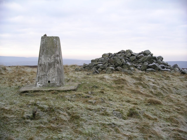 |
| Spartelton from Geograph under CCL by Chris Ellbeck - picture taken when there was visibility |
Dave had over a 90 minute drive now back to Alnmouth. The Satnav took us via Duns and we joined the A1 near Berwick on Tweed. It was dark by then but we reached our hotel in good time for dinner where we were reunited with our friends in Ryedale Walking Group, most of whom had been on a coastal walk near Craster, led by my friend Owen Turnbull. Needless to say, they had enjoyed better weather than we had experienced...but once again it was "Mission Accomplished" for Summits On The Air !