Wednesday 13 January 2016

SOTA in the Estremadura Region of Portugal - Day One

As a SOTA Chaser the area around Lisbon in Portugal attracted my attention. I had made contacts on HF with eight out of the ten summits in the CT/ES area from my home location, so when an opportunity came to take a 4 night break in Lisbon arose in January 2016, I flew out there to activate all ten summits over three days. 

There are seven easy to access summits north and west of Lisbon and there are three not so easy to access summits across the bridge over the River Tajo to the south.  Here is a list of the summits based on how easy they are to reach on foot or by mechanised means - listed from the easiest to hardest:

Northern summits north and west of Lisbon

CT/ES-004 Monte Manique   -  Accessible by car / on foot
CT/ES-007 Serra do Sorocco   -  Accessible by car / on foot
CT/ES-001 Serra do Montejunto  - Accessible by car /on foot
CT/ES-010 Monte Serves  -  Accessible on foot only
CT/ES-005 Monte de Alqueidao  -  Accessible on foot only
CT/ES-006 Monte de Santa Eulalia  -  Accessible on foot only
CT/ES-002 Serra de Sintra  -  Accessible on foot only

Southern summits south of the Rio Tajo River

CT/ES-009 Serra de Sao Luis  -  Accessible on foot only
CT/ES-008 Serra do Risco  -  Accessible on foot only
CT/ES-003 Serra da Arrabida  -  Accessible on foot only

I spent two days activating the seven northern summits, and one day activating the three southern ones. 

Day One - North of Lisbon

CT/ES-010 Monte Serves  -  Accessible on foot only
CT/ES-001 Serra do Montejunto  - Accessible by car / on foot
CT/ES-002 Serra de Sintra  -  Accessible on foot only

After arriving at my Lisbon Hotel the previous night in the dark I woke to a dry day. I breakfasted at 7.00 am and then fought my way through the traffic north of the city beyond the airport, to a parking place on a rough track in a col close to Monte Serves.

Parking place for my hire car near to CT/ES-010 Monte Serves
My track is in red - the GPX file is in the SOTA Mapping Project
The summit with its obelisk like trig point was reached in less than 10 minutes from the car without problem. I made 15 contacts with European stations on the 10 and 14 MHz bands. My friend in Scarborough Roy, G4SSH was first into the log, as often happens...
CT/ES-010 Summit - 5m pole with link dipole attached to the smaller trig point
After just 20 minutes using low power (FT-817 with 5 watts) there were no more callers so I packed up and returned to the car for my onward journey to CT/ES-001 Serra de Montejunto.  This was around 25 miles drive away. I was able to purchase some food and drink at a Lidl supermarket en-route to keep me going for the next three days....

CT/ES-001 Serra do Montejunto

The end of the road on Serra de Montjunto CT/ES-001
At 666m above sea level (ASL) Serra do Montejunto is the highest summit in the Estremadura region and is worth two points for SOTA - all other summits in the area are worth one point.  The summit area is accessible by car. There is no winter bonus available as this only kicks in at 1000m ASL. 

After leaving the A8 motorway (tolls payable at the booth on exit or later by credit card if you have a transponder fitted in the car, as I had) it was a most enjoyable drive through the countryside. I set the TomTom to Praganca, the nearest town to the hill, and then continued up the hill from there to the enormous communications network of masts and radomes on the summit.  After a reconnoitre of the whole area (which is administered by the Portuguese Air Force) I parked near to the large chapel and walked up the hill to the smaller chapel adjacent to the remains of a ruined convent. There was a seat here and this is where I set up my station for a comfortable activation over the lunchtime period.  The winter sunshine and 15c temperature were most welcome... 

CT7/G4OBK/P Station which was set up behind the small chapel
The ruins of the large convent directly adjacent to my operating position
The contact rate was good from the summit as was the propagation and I able to reach AC1Z (CW) and N1GB (SSB) in the USA and 37 other europeans stations before I departed for the long drive to Sintra and the nearby summit of CT/ES-002 which was my last port of call on day one of my tour. 

CT/ES-002 Serra de Sintra

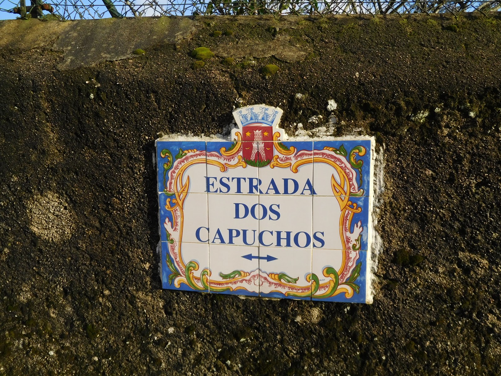
It took me well over an hour to reach the tourist trap of Sintra and then I found myself stuck in the middle of the afternoon on a hilly and narrow lane - part of an extended one way system. Unfortunately I was on the wrong side of the hill I intended to climb... After pulling over I realised after studying the map that I wasn't all that far from the summit of ES-002 Serra de Sintra after all, so I pulled over on to side of the Estrada Dos Capuchos and set off walking this route:


The Royal Park near Sintra is a tourist trap and I was able to avoid all of the people until I reached the summit using this route. The short route was interesting - a rough track and then a landscaped cobbled footpath. It was obvious that work was going on deforesting parts of the park which had become overgrown: 

It was a fantastic and interesting walk to the summit of Serra de Sintra
A large stone plaited cross was mounted on the summit near to where I set up my SOTA station. There were many visitors of various nationalities during my activation and I gave a demonstration of sending Morse Code to several people. I also attempted to explain how SOTA fitted into the hobby of amateur radio, pointing out that what I was doing wasn't citizen's band radio!

Top: ES-002 Summit Cross    Bottom: The Romanesque National Palace of Pena - seen from the summit
I had an appointment with local hams in LIsbon at 18.30 so after 18 contacts on the 20m band I closed down the station. 

The evening meeting was most enjoyable, with David CT1DRB (fellow activator next day), Pedro CT1DBS/CU3HF and Joao CT7ABE attending. We met outside my hotel, with the locals having travelled into the city via the metro. The guys took me to a small restaurant down the street where we had a meal and some beers:

Left to Right: Joao CT7ABE - Pedro CT1DBS - Phil G4OBK - David CT1DRB
This was an opportunity to talk about SOTA, the equipment we use, low power operation, the antennae and batteries etc. I made arrangements to meet up with David CT1DRB the next day on CT/ES-004 and activate together on three of the four summit activations on day two of my tour.

Tuesday 12 January 2016

SOTA in the Estremadura Region of Portugal - Day Two

I left my hotel at  0730 a.m. and made my way north out of Lisbon up the A8 Motorway. It was Tuesday, my second day of three and my plan was to activate four summits. I had arranged to meet David Quental CT1DRB on my second summit of CT/ES-004, and I was hopeful that I could make an S2S contact with David from ES-007 before I joined him on ES-004. 

CT/ES-007 Serra do Socorro

This summit is accessible by car, so I drove up there and walked the final metres to the summit operating position. This is how the Serra do Socorro looked from below as I approached:

The buildings on the summit form a chapel (and I heard from my CT friends - a restaurant). It was a good road to the top, no problem for my Fiat Punto hire car.  I set up the antenna against an information sign:

I enjoyed really good views from ES-007, north to ES-001 where I activated the previous day. I also took this photograph of a housing settlement below me. This looks like lines of newly built terraced houses in the countryside. I think the houses may have been built near to a golf course as I can make out some sandy bunkers in the photo. This illustrates how different planning policy for housing differs between the the UK and Portugal...
The slightly hazy view north to ES-001 from ES-007
The lines of quite new terraced homes seen below from ES-007

After 37 contacts on HF in around half an hour (My friend Nick G4OOE in Scarborough was the first station logged) I packed up the station and had a walk around the buildings on the summit. Whilst strolling round I called CT1DRB on 2m FM with my handheld. David came straight back to me from CT/ES-004 and we had a summit to summit contact. After that I made off for ES-004 to activate it on HF alongside David for a SOTA Complete!

CT/ES-004 Monte Manique


The top of Monte Manique looks interesting, even from a distance. The summit houses a small scale wind farm and an ornamental house behind locked gates. On my arrival I greeted David CT1DRB at the gates which are within the activation drop zone of 25m. We both set up separate HF stations 25m apart.  David using his Elecraft KX-3 and me with my Yaesu FT-817. David took care of 20m CW and I looked after the 30m CW and 20m SSB bands. Here are two pictures of the KX-3 in use and the internals:


Between us we shared 32 contacts. 30m CW was all but closed so I made two contacts there with DL3HXX and DL1FU before moving to 20m SSB. Here is a photo of David activating on 20m CW using a dipole on a 7m high pole:

I was careful on all my activations in Portugal to orientate my dipole east  - west so as to ensure the maximum signal strength was directed due north to my friends back home in the UK, and it paid off as this example from my log shows:


CT/ES-006 Monte de Santa Eulalia

We both drove our cars to the village of Covas de Ferro and turned left on entering the village up a tarmac road leading to a villa where there was room to park both cars. From here a walk of less than 1 Km took us to the summit of Monte de Santa Eulalia CT/ES-006. Here I am having just arrived on the summit:


The partly felled, partly wooded summit is home to a small scale comms installation. I operated around 50m away from David who sat by the old bent mast:


Conditions in the middle of the day were fairly poor on 20m and 30m and we only mustered 26 contacts between us. Back to the car then it was - to eat our lunch before proceeding to the delightful Monte do Alquidao, ES-005. 

CT/ES-005 Monte de Alqueidao

We had around a 30 minute drive from ES-006 and then a pleasant short walk from the car park on a track and footpath took us to the observation tower on Monte de Alqueidao. This was another of the most elevated hills in the area that served as one of the telegraph alerting stations during Napoleon's invasion of Portugal. Here are photos of the observation tower with my 5m travel pole mounted on top, the route taken and my station on top of the platform - a comfortable position to operate from:


I set up my station on top of the platform, whilst David CT1DRB used the height of the platform to mount his 20m dipole as a sloper, with him sitting on the ground below. We made 27 contacts. 
g
 A day to remember for G4OBK and CT1DRB - last summit of four for me - CT/ES-005
David suggested we enjoy a little hospitality before we said goodbyes. Indeed, what a brilliant idea and so we found a little cafe (the Portuguese equivalent of an English "Village Pub") a short distance away on the main road at the bottom of the hill, where we enjoyed a small beer and a local delicacy - saying our farewells before heading back to Lisbon on the motorway...


Monday 11 January 2016

SOTA in the Estremadura Region of Portugal - Day Three

My last day and I decided to concentrate on the three one point summits which lie on the Setubal Peninsula 25 miles south of Lisbon.
Bottom: ES-008 Serra do Risco Middle: ES-003 Serra da Arrabida Top: ES-009 Serra de Sao Luis
CT/ES-008 Serra do Risco

I left Lisbon at 6.45 a.m. by skipping breakfast and filled the car up with fuel en-route to ES-008 also buying a sandwich to supplement my snacks for the day. Fortunately for me, Manuel CT1BWW had uploaded a GPX track into the SOTA Mapping Project and by using this in Viewranger on my phone I was able to locate a roadside parking place near the large quarry here and the track, which led me through scrub to the climb of the hill itself. It took an hours continuous walking in fine weather to reach the trig point:

The quarry men had started work and some blasting was taking place below me as I climbed. Once I reached the turn the rocky path surface was quite difficult for walking. This is not a hill to climb in short trousers or even short sleeves as the sharp foliage encountered (which had grown up to waste height,) would scratch you. I was walking on the top of a cliff, with the sea on one side and the enormous quarry on the other. Despite the summit's name Serra do Risco I did not feel to be at any risk as I kept away from the edge, which was protected by the low bushes.

The morning sun rising over the sea on my way to Serra do Risco
The Quarry
There was just room to peg out my 30m band dipole at the trig point. If the antenna had been longer it would have been too close to the precipitous cliff for comfort. 22 callers came in thick and fast using Morse and Voice - one notable contact was with Carolyn GW6WRW/M who was driving in her car en-route to an activation in mid-Wales and I was able to give her a 5-9 report! Amazingly out of the 22 contacts 13 were SOTA friends from the UK, and again Nick G4OOE from Scarborough was the first station logged: 
My station on the trig: 5m Pole + bungees, 20m/30m dipole, Smartphone for spotting, Logbook, FT-817, 3 amp laptop battery, Pico Keyer, Palm paddle key, Microphone
I could see ES-003 Serra de Arrabida to the north east which was where I was bound for next:


CT/ES-003 Serra de Arrabida

I needed a permit to visit this summit in the National Park. David CT1DRB was kind enough to obtain this for me. This is the text converted to English using Google translate:

After leaving the quarry road to ES-008 I drove along a country road to reach a hamlet called Casais de Serra. From here I turned left down an unsurfaced gravel road and drove for several miles in the Arrabida National Park. My intention was to use the SMP track which had again been provided by CT1BWW, however I wasn't paying attention and drove on beyond the parking place on the narrow track where it difficult to turn the car round. After looking at my position on my tablet I decided to continue on to the hamlet of Picheleiros and use a route from there instead, which was defined on Open Street Map. The image below shows the CT1BWW track in red, my own track in yellow and a track entered after my activation by David CT1DRB in orange. I think if I had known about David's route I should have taken that, as this route from Picheleiros was most challenging. 


It took me 73 minutes to reach the summit. The path was steep and loose in places and I was glad of my walking poles both ways - without them I feel the ascent and descent would not have been possible by this route. It was a beautiful sunny day now with temperature of 16c and most pleasant to be walking in a thin long sleeved microfleece and no jacket. Once again on this walk you would not want to be wearing shorts or a short sleeved shirt on account of the sharp scratchy bushes. 

Cave off the side of path on the way to the summit of Serra de Arrabida
The track I followed from OSM was accurate and eventually the summit was reached. The views were superb and it was worth the effort in getting there, even though the summit was worth just one point. 
Serra de Arrabida CT/ES-003 on 13th January 2016
A ship heading into Setubal and several paragliders flying from a nearby hill
The 10 MHz (30m) band was closed - there was null propagation, so just 14 MHz CW/SSB was used. I completed 15 contacts in a short period of time, starting with Frid DL1FU in Germany and ending with Vrata OK1KT in the Czech Republic, both personal friends of mine who I have met thanks to Summits On The Air. Much care was needed on some sections getting off the hill, and thanks to my extended walking poles I made it back to the car with a few minor stumbles but no physical damage to my person on the descent. The area was remote and I saw no one at all. This was not a place where you would want to injure yourself and be unable to move. However I was comforted by the strength of mobile phone signals which were excellent throughout the Estremadura Region. Glad to say the only reason they were needed was for spotting my activity for Summits On The Air... 

CT/ES-009 Serra de Sao Luis 


Pleasingly once I left the crossroads at Picheleiros below ES-003 the road to ES-009 was asphalt and it wasn't far from from the Picheleiros crossroads either to the parking place for my final summit of the tour.  I drove up a gravel track once I left the EN-10 road as far as I could to finish just below ES-009.  I parked up when it became too rough to proceed in the Fiat. From there it took me 33 minutes to walk to the summit - a 1.25 mile walk with over 600 feet of ascent. It was easy walking though, thankfully, as by now I was feeling the 3000 ft of climb of the day - the wide gravel track took me right to the summit, where there was yet another communications installation and some buildings owned by the Portuguese equivalent of the UK Forestry Commission. 

One of the wooden buildings behind a fence on Serra do Sao Luis
The unusual geographical feature of the Troia peninsula - a marina and three hotels
After telephoning Judy (my XYL back in the UK) to let her know I was safe on my last summit of the tour I set to and worked thirty stations - starting on 14 MHz first. CT1GZB in Lisbon (Line of sight but still some distance away) was 5+9+30db and the strongest station I believe I worked all tour. There were lots of UK stations in the log - the last contact being with David G3RDQ on the 30m band. 


No wonder I'm looking pleased in this selfie - I'd finished a tour that may not have happened at all... It was touch and go whether I could fly out to Lisbon on the day of the Ryanair flight itself, which left Manchester at 1710 hrs. The planning for most of the summits visited was done on the morning of the flight day and in the Red Frog Speakeasy bar with David CT1DRB, Pedro CT1DBS and Joao CT7ABE over some beers at the end of day one of my tour. Thank's guys for your hospitality, advice and welcome to your country. 

During the course of activating the 10 summits I drove over 600 Km in my Fiat Punto hire car, much of it on the motorways north and south of Lisbon. Two weeks after arriving home the toll cost showed on my credit card for the motorway tolls - £15.45. A small additional cost was the transponder hired from Eurocar so that I did not have to stop at the barriers on the motorway exits - at a cost of €7, this was well worth it. 

So I am 10 uniques the richer, of which 9 are SOTA Completes.  216 Portugal QSOs were logged to add to the 369 QSOs previously made on my CT7/G4OBK/P Algarve Tour in September 2014. This last day of three had been tough - although I only walked 6 miles in total I had climbed almost 3400 feet. 

Sunday 3 January 2016

Another wet day in Wales - GW/SW-015 and GW/MW-016 on 2m FM

January 3rd 2016 and I had to go to Bristol on business. It's too far to drive there and back from North Yorkshire in a day so I decided to turn my visit into a two day SOTA trip and on the way back through Wales meet up with Geoff 2E0NON who lives near Malvern. 

GW/SW-015 Mynydd Llangorse

We would have liked to have activated SW-035 Mynarth, which is near Brecon. However that summit would be left for later as access is not permitted during the shooting season. We have an assurance from the Usk Estate that we will be allowed there once the season is finished, and it now remains the last remaining South Wales summit unactivated by us. So SW-015 it had to be. We'd been here before in December 2012 and failed badly - we didn't make a single QSO. See my previous blog report. The summit is surrounded by higher hills and this makes it difficult to make contacts on 2m FM. This previous attempt was before we took up carrying a more powerful transceiver and battery. This time rather than running 5 watts to our vertical dipole we ran 50 watts and we were hoping for success... 

Leaving Bristol at 6.15am I crossed the Severn Bridge - the toll charge having increased by 10p to £6.60 at the turn of the year. The weather was very bad, with heavy rain and it wasn't stopping when I arrived at the col between Mynydd Troed (GW/SW-009) and Mynydd Llangorse (SW-015) at 07.45am. Geoff appeared shortly after that and we set off for the summit with our golf umbrellas and radio gear. We stopped short of the top and found some shelter from the wind below the ridge inside the 25m activation drop zone: 
Geoff on Mynydd Llangorse - his old brolly collapsed due to the strong wind
CQ calls on 2m produced the four contacts needed in 11 minutes and we got off the summit as quickly as we could. 

Stuart, G0LGS in Cheltenham was our 4th contact after calling CQ for some minutes. Stuart has helped us out with contacts on lots of summits in Wales and the Welsh Borders. We met up with him a couple years ago on a fine day when we were activating his local summit of Cleeve Hill, G/CE-001. As time was short we chose another unique summit to activate to the north, this was near to Builth Wells.

GW/MW-016 Pen y Garn-goch

If you read the comments on hillbagging,co.uk and on the SOTA Reflector people have had problems getting to the summit of Pen y Garn Goch due to tree cover. When you look at the latest OS Map (25K and 10k Streetview) "rides" have been added to the map which were not shown on previous maps of Irfon Forest. Due to logging operations some of these rides have been turned into graded tracks and this is what we used to reach the summit trig point. There is parking for a couple of cars at the entrance to the forest at SN 891504:

Ordnance Survey 1:10K Streetview GB Mapping - this GPX track is on Viewranger and in the SMP
The walk to the summit took 35 minutes and we arrived at the trig without a single scratch between us... 
Geoff 2E0NON preparing the antenna on GW/MW-016
We had a little more success with the 2m operation here and completed six contacts:

As we packed up the rain finally stopped and our walk downhill was quite pleasant - then a rainbow appeared:


Another two summits completed - and we will be back activating in Wales later in the year.