Monday 27th June was a long driving day - 200 miles driven by Victor from a start point hotel at Marktoberdorf. We walked 3 miles all told to garner 22 points on five rather non-descript, but easy to access summits in the Bayern (DM/BM) District towards the end of our journey:
We drove for around 150 miles, well beyond Munich, before we reached our first of five summits. DM/BM-378. Google map of our days journey to the village of Lintach, near Amberg:

When we arrived at our Gasthaus in Lintach the attached restaurant we thought was open was closed - the fraulein proprietor said this was "due to Corona". It hadn't re-opened since the start of the crisis, so we had no choice but to take a shower and then drive back to Amberg where we found something to eat in a restaurant on the edge of a park. It wasn't so good, unlike the previous meals we had enjoyed in Germany.
Tuesday 27 June was a far more interesting day, when we travelled to Gasthaus Fidelis in the village of Grafenweisen where we stayed for three nights. This was a perfect location. Grafenweisen is centred in the DM/BM area ten miles from the Czech border. There is an excellent restaurant at the Bahnhof owned by a lovely hard working Pakistani chap, and a plethora of high scoring easy to access summits in the DM/BM area that kept us occupied for three days. Summits shown below are within 25 Km radius of the village:

Overshadowing Grafenweisen is the summit of DM/BM-368 Schwarzriegel (10 points), the towers of which can be seen from many miles away. The place is called sektor F, and was an intriguing cold war eavesdropping intercept station used by the west. The site has been sold off and is open to the public. There is an elevated viewing platform (293 steps!). I'd like to go back and further investigate as our SOTA itinerary would not permit us the time to do this on our tour. The next day we visited the east side former Soviet bloc eavesdropping site in Czechoslovakia (as it used to be) on Cerchov OK/PL-088, but that is another story. The two cold war listening sites are only seperated by around 25 Km.
Whilst planning the tour I found a walked track in the SOTA Mapping Project from my friend Markus HB9DIZ. The walk from the top of the Hohenbogen chairlift into the activation zone of sektor F I would grade as "easy", here are some photos:
 |
| €11 return ticket up to the start of the walk into sektor F and Schwarzenriegel DM/BM-368 |
| Hohenbogen Chairlift €11 return fare |
 |
| The towers in sektor F |
 |
| The suntanned Victor DL/G4ONL/P at the top of the lift |
 |
| My operating position on DM/BM-368 - about 400m from Victor's |
This summit was in my top five of the 36 visited on the tour.
However earlier in the day whilst the dew was still on the grass, we activated DM/BM-349 Hungerleite, also called Rotbuhl (673m). Less than a 10 minute walk to the summit from the car park. No one else there that early in the morning.
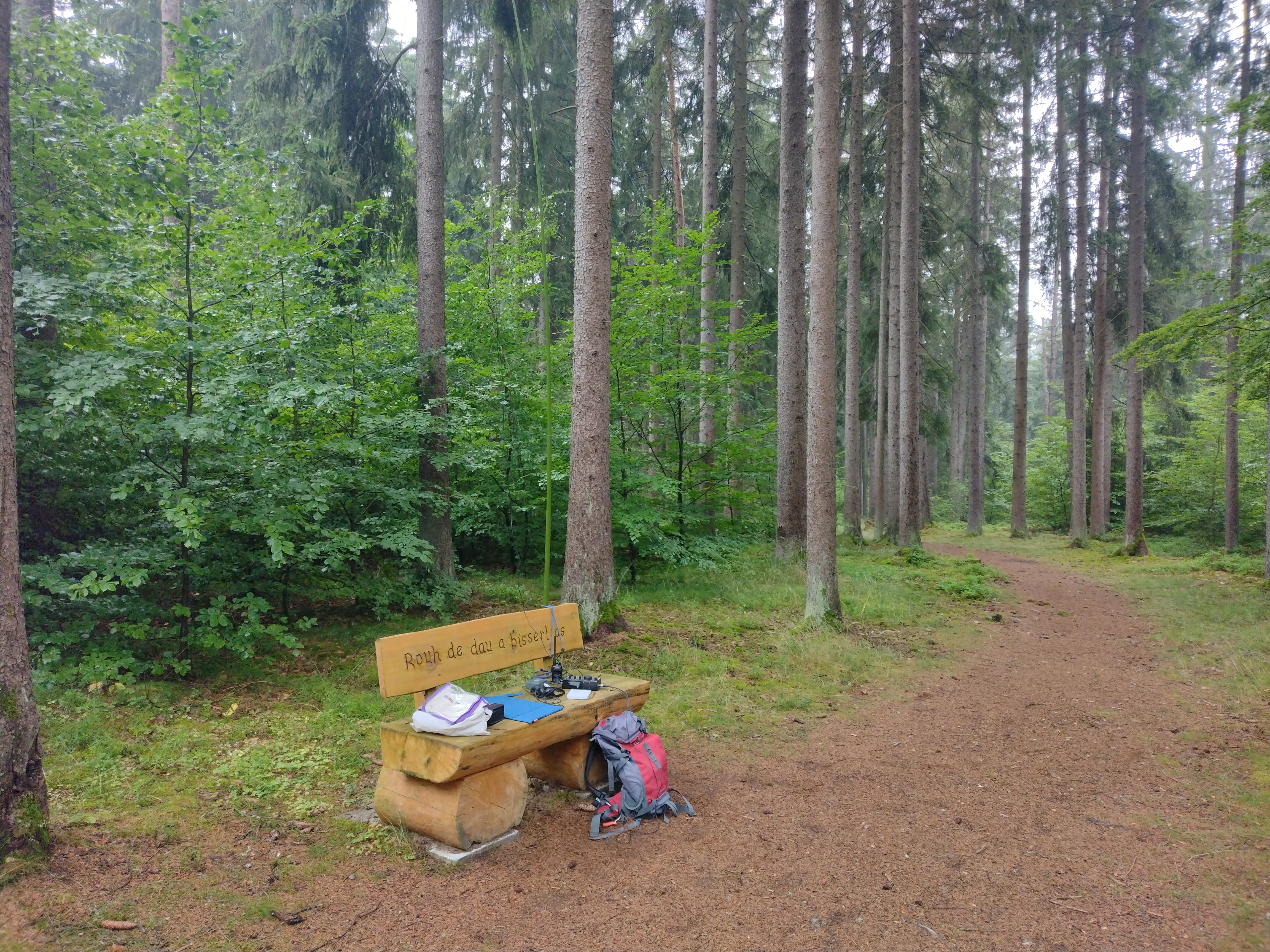 |
| DL/G4OBK/P station on Hungerleite DM/BM-349 |
The day went like this, with five summits activated for another 34 points:
Distance driven 68 miles distance walked 7 miles (+1.5 miles on chairlift)
No comments:
Post a Comment