Sunday, 19 May 2013

Ryedale Walking Group - Yorkshire Three Peaks Weekend

Our Yorkshire Three Peaks' Route - we started from Horton
24.2 miles walked with 5200 feet ascent
Over the long weekend of 17th - 20th May 2013 members of Ryedale Walking Group enjoyed a holiday in the Yorkshire Dales, staying at the Rendezvous Hotel in Skipton. Saturday turned out to be wet so in consultation with my friend and joint leader Geoff Fielding we made a decision to postpone our walk over the Yorkshire Three Peaks of Pen-y-Ghent, Whernside and Ingleborough until the Sunday. Fortunately all twelve members who had registered for the RWG Three Peaks Challenge were still able to take part, and this turned out to be the right decision as the conditions on Sunday were perfect for the walk. 

Under starters orders for the RWG Yorkshire Three Peaks Challenge

After early breakfast at 6.00am, served by the hotel night porter at The Rendezvous Hotel, I led the group away from the traditional start at the Pen-y-Ghent Café in Horton, at 07.55am. The age range of members taking part was from 17 to 68. One member felt unwell soon after the start and returned to Horton with a friend. Meanwhile the remaining ten members continued with the first group reaching the summit of Pen-y-Ghent exactly an hour after leaving the Café at 08.55am. After a 15 minute drink break, when Phil and Geoff made a few amateur radio contacts for SOTA, we were descending down the Pennine Way towards Tarn Bar for a comfort break (09.39am). 

We then used the new section of path over Whitber Hill and Sell Gill Hill. What an improvement over the old wet route across Todber Moss! The Dales National Park have done a brilliant job here for sure by creating a sustainable dry route.

Young RWG Member Will heads up the group on the new section over Whitber Hill
The same can't be said for the section of route when we left the Pennine Way to make for the flank of Dismal Hill, which it truly was, with the path being in a terrible slippery state due to the heavy rain of the previous day and the passage of boots. I was ahead with new member Chris and we reached the B6479 Ribblehead road at 11.12am.

Ribblehead Tea Van - 10 miles completed
With handheld radio on board I was able to inform my co-leader Geoff (who was bringing up the rear as back marker) that Chris and I would push on to the tea van at Ribblehead to order food and drinks for the group, which we duly did arriving there at 11.30am. 
Lunch break on Whernside - 14 miles completed
After a 20 minute snack break (less for the tailenders) we set off for Whernside, with all of us reaching the summit in just under two hours for our 15 minute lunch break. Geoff and I managed once again to snatch a few quick radio contacts for SOTA before departing. At this point the baton was passed to Geoff who took over leadership of the walk until we reached the top of Ingleborough.

Before Chapel-le-Dale we stopped at Philpin Farm refreshment caravan and toilets to enjoy another 15 minute rest stop, leaving at 2.57pm. The farm provides a great summer service here, an oasis just off the B6255 road between Hawes and Ingleton. The outdoor café also being used by passing motorists. 

Philpin Farm Cafe  - 16.5 miles walked (thanks to Steve Partridge for the photo under ccl)
With renewed vigour Geoff led us on to the summit of Ingleborough with me as back marker arriving at 4.20pm. After a few more ham radio contacts for SOTA we only lingered for 10 minutes before I took over leading the group off the summit across the limestone pavements of Simon Fell Breast and Sulber Nick, where we had our final brief 3 minute drink break at 5.30pm. 

The group crossing Sulber Nick (22 miles walked)
We rolled into the Pen-y-Ghent Café all together as a group at 6.20pm, having finished the whole 24.2 mile / 5200 feet ascent Three Peaks route in 10 hours 25 minutes.  After pints of tea in the café Chris kindly invited us to the Crown Inn for a drink before some of us headed back to Skipton for our dinner at The Rendezvous Hotel. The remaining members stayed for a meal at The Crown before heading back to Ryedale. 

Congratulations to the six RWG members qualifying for membership of the Yorkshire 3 Peaks Club: Ellie, Chris, Sally, Annie, Kit and Rachel.

The happy RWG Yorkshire Three Peakers at the finish (24.2 miles)
Geoff, Martin, Will and Phil were already members, having done the walk before. 

Thursday, 2 May 2013

Wainwright's Pennine Journey Greenhead to Appleby - April & May 2013

Day 13: Monday  29 April 2013

Greenhead to Slaggyford (11.2 miles 1450 ft ascent)


After a gap of over six months we resumed our 247 mile walk on Wainwright's Pennine Journey. This time all six of us were present for this four day, 42 mile section from Hadrian's Wall at Greenhead to Appleby Railway Station:


Jen, Phil, Geoff, Yvonne, Judy and Chas outside The Greenhead Hotel
We parked our cars at Appleby Railway Station the previous day, paying the £8 fee for five days.  We then caught the train up to Haltwhistle (via Carlisle), Haltwhistle being the nearest railway station to Greenhead, where we left off on Pennine Journey last October. 

At Haltwhistle Station we were met by Gary, the proprietor of Diamond Taxis of Haltwhistle  (Tel: 07597 641222). Gary transported us to the Greenhead Hotel, which we can wholeheartedly recommend for accommodation, friendly staff and good food.  He also took the above photograph! 

So what you do you in Greenhead on a Sunday afternoon? You go walking of course, before retiring for a drink at the bar. I chose us a short circular route from the hotel. It was a showery day, but we filled our time well and only got a little damp:

Our circular walk from Greenhead 
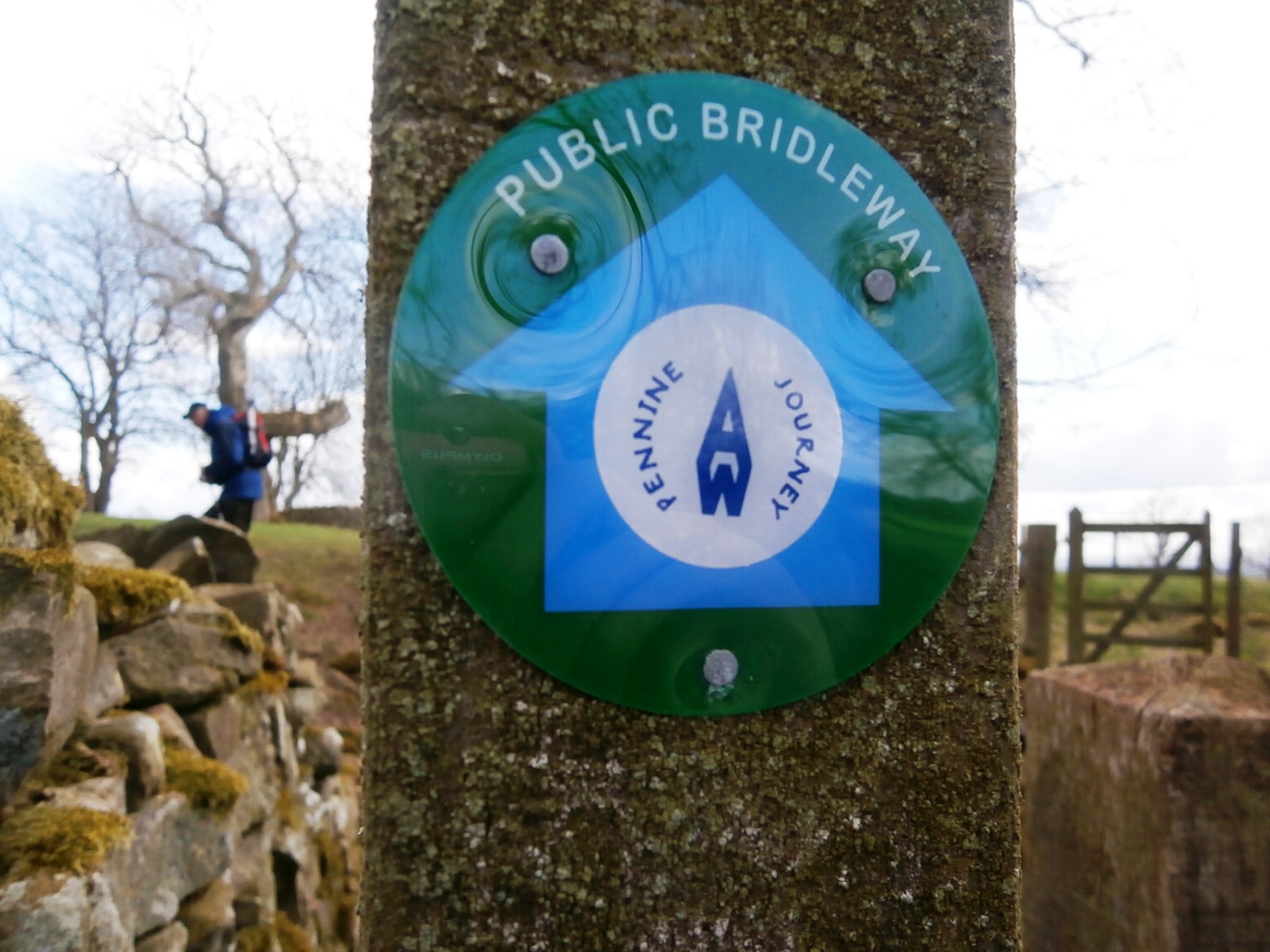
Returning to the hotel late afternoon I set about preparing for the next day's 11 mile walk to Slaggyford.  As a keen member of the Pennine Journey Supporters Club (PJSC) I was approached by Jill King, the Route Coordinator of Pennine Journey prior to our departure who asked if I was prepared to inspect the route and report on any footpath problems encountered. This I was happy to agree to, and I was also carrying David Pitt's excellent guide book to the route and looking for any changes made to footpaths since the book was published.  We found that Pennine Journey Waymarks had started to appear on most sections of the route displaying the distinctive logo. 


On Monday morning we left Greenhead for our 11 mile walk at a deliberately late 10.30am. There was a reason for this - we would normally get away just after 9.00am, however our friendly taxi man Gary was assigned to a school run and could only meet us at Slaggyford at 4.30pm, when he would return us to Greenhead for a second night in the hotel.

The weather was pleasant as we crossed the A69 and made our way over Blenkinson Common on what was a mixture of cultivated grazing land and boggy moorland - typical Northern Pennines country. We joined the Pennine Way once again through to the A689 road near Lambley, an old coal mining area in the South Tyne Valley.   By early afternoon we were walking under the 260m long nine arched  Lambley Viaduct, which once carried the Haltwhistle to Alston Railway. The railway operated between 1852 and 1976 and carried mainly coal trains north from the Alston mines. 
Lambley Viaduct through the trees - the South Tyne River passes underneath
As we used the steps down to pass under the arches of the viaduct I made a note that one of the wooden steps was rotten, this information was sent on with other footpath observations to Jill King who would bring these issues to the attention of the highway authority. Once under the Viaduct the Pennine Journey shares the South Tyne Trail for the four miles to Slaggyford.  The way is relatively flat as the trackbed of the former railway line is used and good progress can be made. We arrived in Slaggyford near the old Stationmaster's house at 4.15pm in good time to meet our taxi. 


Slaggyford Station - the platform is still there
Lovely stained glass windows in former Methodist Chapel in Slaggyford
Slaggyford no longer has any amenities, although we noticed it does have several quality holiday cottages to let and a large caravan / camp site. Taximan Gary arrived right on time at 4.30pm on a sunny afternoon to transport us back to the Greenhead Hotel. 

Day 14 Tuesday 30 April 2013 Slaggyford to Garrigill  (10.5 miles 1300 ft ascent)

We had an earlier start today - our friendly taxi driver Gary of Diamond Taxis collected us at 9.30am after his school run and deposited us at Slaggyford where we continued following the South Tyne valley down to Garrigill.  We were walking by 10.00am.  On this section we left the trackbed of the railway as the railway actually exists again up to Lintley, where there is another marvellous viaduct.  The heritage line is the South Tynedale Railway which is run by the South Tynedale Railway Preservation Society. 


Some of the group make way under Lintley Viaduct 
The line is the highest narrow gauge railway in England with the main station being in Alston, where we hoped to have our lunch later en-route to Garrigill. It is the long term objective of the society to re-lay and reopen the line right up to Haltwhistle.  Fortunately the viaducts along the route have remained intact, however there are many obstacles to overcome if this idea is to be achieved. 


On the footbridge below Lintley Viaduct on Wainwright's Pennine Journey
We had an obstacle to overcome - albeit a minor one, caused by my navigational error. Referring to David Pitt's guidebook and my map we followed a clear route from the viaduct and this took us alongside the railway platform at Lintley Halt - no mention of this in the book or the map as it was new!  We turned around and walked back about 200m to rejoin our path which was now intending us to follow the route of the Pennine Way once again, the South Tyne Trail at this point being supplemented by a new railway line! 

Lintley Halt - the end of the line at present on the South Tynedale Railway
From Lintley we took to the fields and mucky farmyards of the Pennine Way route, crossing the A689 road to climb up and circuit the former Whitley Castle. We then proceeded to drop downhill into Gilderdale where we left Northumberland when we crossed Gilderdale Burn and entered Cumbria. 

Judy & Jennie climbing out of Gilderdale - now we are in Cumbria on our way to Alston
The A689 was again crossed at Harbut Law as we neared the former lead mining capital of the North Pennines, Alston. As we approached the town I was looking out for a dilapidated seat, which was mentioned in David Pitt's Guidebook, and we found it. 


The dilapidated seat near Alston
We entered Alston for our lunch after diverting from the "official route" at the riverside path.  After passing a hotel and a garage we found our oasis - The Cumbrian Pantry Cafe where we enjoyed our lunch. I think everyone ordered something different, varying from jacket potatoes to scrambled eggs on toast! The chef, a young fellow, was diligent and produced for us a fine lunch at an economical price. 


The Cumbrian Pantry - lunchtime location in Alston
The main man in these parts in the lead mining days of the 19th century was Jacob Walton - a man loved and esteemed by his employees, so much so that a monument was erected in Jacob's name.  In 2000 money was raised to restore and re-erect the monument, and this was achieved in 2004.

Judy - Jennie - Yvonne - Chas - Geoff after lunch at the Jacob Walton Monument in Alston
Wainwright's Pennine Journey route continued to follow the Pennine Way south of Alston on an elevated path above the river. This stretch was beautiful and we once again saw Snipe and Dippers flying up and down  the valley.  We searched for a footbridge south of Sillyhall over the river and found that it had been washed away evidently, so we ventured further downstream a short distance to discover the main bridge near Dryburn which carries the Pennine Way was still in existence. The missing bridge was reported as part of my observations to the Pennine Journey Route Coordinator Jill King. 


The substantial footbridge at Dryburn which at present carries Wainwright's Pennine Journey
We emerged on to the public road half a mile north west of the village of Garrigill, a village now a shadow of its former self with many of the cottages used as holiday homes.  There remains a pub, the George and Dragon, which thankfully reopened in December 2010 under new management. Meals are now served, but there is no accommodation.  Garrigill is an important staging post for walkers and cyclists undertaking long distance routes. This brings visitors and money into the village and helps to keep the wheels turning. Judy and I stayed at East View B&B (en-suite). This was quite adequate for our needs, very comfortable, and there was free WiFi. The others in the party stayed at the rather quirky Old Post Office (no en-suite) run by Margaret.  Although I only dealt with Margaret on the phone I was told she was quite a character!

The food served in the George and Dragon was traditional pub grub which was thoroughly enjoyed in the rustic surroundings.  We were made very welcome there.  Well fed, we retired ready to face our ascent of Cross Fell from the north side the next day. 

Day 15 Wednesday 01 May 2013 Garrigill to beyond Milburn   (14.3 miles 2250 ft ascent)

Phil (Writer), Judy, Chas, Yvonne, Jennie, Geoff ready to leave Garrigill for Greg's Hut and Cross Fell
Although I had split the route up into shorter sections which differed from the length of sections in the guide book, this was still likely to be our toughest day of the whole 247 mile walk.
Cross Fell at 2930 feet is the highest point in the Northern Pennines. I had climbed it twice before in lying snow and mist from the Great Dunn Radar Station access road, but never from this north side, and although the way was long the ascent was easy,  this route being gradual and on good tracks for the most part.  In the event, only the three men on the walk diverted to the summit, the ladies remained in the dry by waiting in the relative comfort of Greg's Hut, a mountain bothy on the north side of the mountain below the summit at a height of 2300 feet. It did start to rain once we climbed above 2000 feet, where there was still patches of lying snow.


Geoff now ahead of me on the track near Greg's Hut
After leaving Garrigill at 9.30am we reached Greg's Hut after 6.5 miles at 12.20pm. The hut is very well equipped with a raised floor for sleeping and a stove with material to light a fire. It had been left in a tidy state and we left it as we had found it. 

Doorplate on Greg's Hut
Geoff - Jennie - Judy - Yvonne - Chas - Phil at Gregs Hut
So after a bite to eat the three of us set off on a short 12 minute walk to the Yad Stone. This is where the path up to Cross Fell climbs a further 400 feet along the Pennine Way  to reach the summit of Cross Fell. The Pennine Journey continues straight on and we had arranged a rendezvous later with the ladies at the Yad Stone.  At this point in Pennine Journey David Pitt made reference to an engraved boulder which indicates the way, and this we found:

The engraved boulder at the Cross Fell path junction 
From the engraved boulder it took us 15 minutes to reach the Cross Fell shelter in mist and drizzle.  The object of the exercise was for Chas and Geoff to bag the summit, and for Geoff and I to operate on ham radio for Summits On The Air  (SOTA).  We stayed 20 minutes and made 12 contacts with radio hams around Cumbria, Lancashire and the Wirral using low power on VHF. We talked to Dave G0EVV on Great Gable and M0HIQ Derek on Pendle Hill. My callsign (since 1982!) is G4OBK and Geoff's callsign (new this year) in M6PYG.  

Chas and Geoff at the shelter on Cross Fell in the cold rain and mist
We met the girls back at the Yad Stone and made our descent into the Eden Valley with the weather steadily improving. By the time we neared Kirkland we were in full sun and down to tee-shirts, most pleasant after what we suffered higher up.  As we followed our guide book and OS map we realised that when we reached Wythwaite we would have to cross stepping stones at Crowdundle Beck, so we were pleased to see when we arrived there that Cumbria CC had provided us with a new bridge. Jennie isn't that keen on stepping stones after she came off the stones at Bolton Abbey last year whilst I was helping her across!

The new bridge at Wythwaite which is elevated well above the watercourse
Looking back up to Cross Fell it was full sun and a clear blue sky - pity we hadn't climbed it later in the day, but we had a strict schedule to stick to.  We walked through Milburn village with its enormous village green and 20m tall maypole which was not in use, even though it was May 1st. According to Wikipedia the tradition of maypole dancing has never taken place here, despite the pole being there for at least 150 years!  
Low Howgill Farm

We proceeded to what turned out to a most luxurious B&B at Low Howgill Farm, where our host Jane, treated us to home made cakes, scones and pots of tea - superb!  This of course like all the accommodation on our route, had been pre-booked. 

We had parked Geoff's car here the previous Sunday and used this to take us to a local hostelry for our evening meal - this was at The Masons Arms in Long Marston which was three miles from the farm.  We weren't made as welcome here as we were in Garrigill but we had a good meal at a reasonable price. 

Day 16 Thursday 02 May 2013 Milburn to Appleby Station  (8.5 miles 700 ft ascent)

We had left our cars parked at Appleby Railway Station which was our destination, making this an easy day of pastoral walking.  The weather was now settled as we made out way through the villages of Knock and Dufton.


Teabreak on Dufton Village Green in lovely weather
The route then took us down into Dufton Ghyll Wood, managed by the Woodland Trust and a beautiful place to walk.  We then followed field paths into Flakebridge Wood and so on to Appleby and the finish of our four day 45 mile section of Wainwright's Pennine Journey. 


We near Appleby on our last day
We intend restarting in July when we will walk from Appleby to Sedbergh over four days. We're really looking forward to continuing on our way.....

Wednesday, 13 February 2013

G4OBK SOTA Shillhope Law G/SB-006

The XYL and I were staying at Longhirst Hall Hotel near Morpeth on a short winter break which we booked through Travelzoo. We had planned to tour the area and climb The Cheviot.

The weather intervened when it snowed so we had to "lower the bar" and do something else. Instead, we drove up towards the Scottish Border at Rothbury and thence on for a considerable distance up the Coquet Valley north west of Alwinton to a parking place near an old school at Wedder Leap.

Wedder Leap in Coquetdale - the old school and parking spot is in the background
This was to be our start point for a short climb in the snow up to Shillhope Law G/SB-006. The route is well documented in other reports - here is picture of the track we took taken from my GPS:

This is a two mile return walk with an ascent of about 850 feet
The army uses the land on the opposite side of the valley, but with it being misty we couldn't see what was going on across the valley. And !!BANG!! it was. As we neared the gate and the right turn at NT 8731 1017 there was the loudest bang I have ever heard in my life. It sounded so close to us. We both sensed something, like a change in air pressure I'm not sure, a fraction of time before it happened. After this we heard smaller arms being fired; thankfully the loud bang was not repeated - it was pretty scary. 

G4OBK XYL Judy arrives suffering from shell shock at Shillhope Law Trig Point
We reached the summit in falling snow in less than 45 minutes. I had problems with a high SWR, I think this was due to snow melt in the N connector on the coax feeder. I was carrying my Yaesu FT-857 and vertical dipole as I was not hopeful of qualifying the summit with the usual 5 watts. In the event I did manage it, making just four contacts:


I had to be as brief in QSO as I could be. We were becoming concerned for our safety, so we packed up and got back down to the car as quickly as we could once the 4th station was logged.

24 minutes it took to leg it back to the car at Wedder Leap 
It was no trouble getting out of the valley and back to Rothbury as the road had been gritted. We found a cosy cafe and had some lunch. Getting back to Morpeth from Rothbury later was different though, when a bus got stuck on a hill ahead of us. The police arrived and somehow managed to get the bus moving and we were only held up for around 15 minutes. This was to be our only activation of this trip north, but I planned to re-visit the area for the SOTA International Cycle Weekend in the spring and bag some more Marilyns then for SOTA. 

Monday, 7 January 2013

Great Sugar Loaf EI/IE-022 Wicklow Mountains

G4OBK/P becomes a SOTA "Mountain Goat"
January 7th 2013 in Ireland
Great Sugar loaf IE-022 which I photographed from Djouce Mountain IE-008 the next day
In late 2012 my XYL Judy and I decided to book a short break in Ireland in early January. Flights were booked from Manchester via Jet2, and a car was hired which we collected at Dublin Airport. The Transpennine train was used to get from Yorkshire to Manchester Airport. This is an excellent service from east to west. 

Our holiday was as usual booked via the internet. As a subscriber to Travelzoo I get sent some excellent mid-week deals and this holiday was a combination of a Travelzoo deal staying at Clontarf Castle Hotel on the outskirts of Dublin for two nights, and three nights which I booked on a separate internet deal at Druids Glen Golf Resort, which was reportedly five star, and yes, it deserved it. These were the sort of places we would probably not be prepared to pay for at full tariff in summer, but in winter the tariff is most reasonable! 


Druids Glen Resort Hotel near Newtown Mount Kennedy Wicklow
Clontarf Castle Hotel Dublin
On arrival at Dublin we headed for Eurocar to collect what turned out to be a Hyundai Diesel model i40. Big mistake! When we reached the hotel, about 35 miles south of Dublin Airport, the electric handbrake locked on the car whilst stationary and the car was stuck on the posh hotel concourse..... I somehow managed to free it off, but in the process the handbrake switch broke off and fell inside the centre console housing, so first job next day was to drive back up the coast via Bray and exchange the vehicle for something better. There was no problem doing this and I was given a very solid VW Passat Diesel Saloon instead. 

The climate in Wicklow in January was surprisingly mild and we were amazed to see flowers growing in municipal parks and on traffic islands around Dublin, indicating a lack of heavy winter frosts. 

I had taken my HF amateur radio gear (Yaesu FT-857) and I had planned to activate the Marilyn SOTA Summit of Great Sugar Loaf for 9 points (6+3 for the winter bonus) for Summits On The Air. This would give me the 1000 points I needed to qualify for the Mountain Goat Award, something I had been striving towards since 2005 when I started climbing summits whilst carrying radio gear (some call it "Adventure Radio").

Along the way I had become slightly distracted thanks to a certain Mr A Wainwright and the Wainwrights On The Air (WOTA) scheme, although taking part in that got me on top of all the Lakeland summits earning me valuable SOTA and WOTA points, effectively killing two birds with one stone. 

Judy looks towards Little Sugar Loaf IE-052 as we climb Great Sugar Loaf
So on to Great Sugar Loaf and my Mountain Goat activation. This took place on 8th January 2013. It was a cloudy, windy miserable grey day - not the best for sitting around for over an hour on a 501m high six point summit trying to send Morse Code, but this is what I did, with my ever patient XYL (Wife Judy) sat by me..... 
The Mountain Goat I now am - on Great Sugar Loaf EI/IE-022!
Using the OS Ireland 1:50000 map No.56 I found a parking spot on a tarmac back road south of Kilmacanogue, grid ref 247128. From here we found a path through the gorse to the main path which goes up to the summit at 237127. The hill consists of attractive quartzite rock with the final ascent an easy scramble. There was no cover on top.


Judy descends from Great Sugar Loaf down a quartzite rock gully 
I was on the air for 55 minutes and completed 71 contacts on 10MHz CW (45), 14 MHz CW (18) and SSB (5) with a link dipole and on 145 MHz FM (3) using a quarter wave whip. This included a 2m FM contact across the water with John GW4ZPL who lives near Caernarfon.   The qualifying 4th contact was on 30m CW with my good friend Ken GM0AXY from near Edinburgh, who I climbed Ailsa Craig (GM/SS-246) with in 2009. 

On our way to the pub - Great Sugar Loaf behind
The activation complete we packed up and headed down for a pleasant lunch and celebratory drink at the very welcoming Glencormac Inn in Kilmacanogue, only a mile from the summit. It should be noted that this pub does not serve meals in the evening, if it had then we would have returned there as it was excellent. 

Stats:

Distance walked: 2 miles approx
Total ascent: 1100 feet
Time taken out and back: 3 hours
Time on air: 55 minutes
Transceivers: Yaesu FT-857D (50 watts) LiPO 5AH battery
                       Yaesu VX-170 Handheld (5 watts)
Antennae: HF Link dipole and 2m 1/4 wave whip
Amateur Bands used: 30m CW, 20m CW, 20m SSB, 2m FM.
Contacts Made: 71

(Djouce Mountain EI/IE-008 next day to follow)

EI/G4OBK/P Djouce Mountain EI/IE-007 9th Jan 2013

Harveys 1:30000  Map of the Wicklow Mountains showing car park and route to Djouce Mountain 
The day after I became a SOTA Mountain Goat we were due to move north to a hotel on the outskirts of Dublin. That was later in the day, so we left Druids Glen Hotel near Newtown Mount Kennedy and headed inland to Glendalough, a fairly low key touristy spot surrounded by the Wicklow Mountains. It was a bright and frosty morning and we had allowed enough time to look around the village and visitor centre and have some lunch, before activating our chosen summit of Djouce Mountain (725m 10 points). 

The Norman tower at Glendalough - there was still a heavy ground frost at midday
From Glendalough we drove north east in the direction of Dublin and parked the hire car on a track just off the R759 road on the opposite side to Lough Tay at grid reference 170076. 
Car park for our walk up Djouce Mountain - we headed off right of the conifer plantation
Lough Tay below us as we climbed up to Djouce Mountain
After setting out on a gravel track which was actually part of The Wicklow Way, a 79 mile long distance footpath, we turned left after around 300m and discovered that the path to the top of the mountain consisted of long railway sleepers laid side by side on which chicken wire and 1000s of metal staples had been driven to aid grip. 

The Wicklow Way railway sleepers - providing excellent grip over the boggy land
We soon reached the JB Malone memorial stone. He was one of the pioneers of Irish Hill Walking encouraging many people to take up the hobby. JB Malone was the founder of The Wicklow Way LDP. 


The way was easy on the sleeper track and considering this was a 725m high mountain I would rate the walk to the summit as "moderate", this was because we had started from a height of 460m above sea level.  Once we gained some height beyond the JB Malone memorial, the views were impressive and I was sorry I could not spend more time in the area as I looked towards Kippure (IE-005) less than five miles away.


Kippure IE/EI-005
I was travelling light and only carrying a small VHF 2m FM handheld radio, a Yaesu VX-170 with quarter wave whip, yet I was surprised to make eight contacts from the summit, including a most memorable one with Karen 2W0XYL/P who was on her Mountain Goat Activation on the 1001m summit of Glyder Fawr GW/NW-003 in Snowdonia. I followed that with two more Welsh summit contacts with MW0JLA/P Rod on GW/SW-001 and MW6BWA/P Vicky on GW/SW-005 in South Wales.  
Stations logged from Djouce Mountain EI/IE-007
Operating from the summit of Djouce Mountain "G6ODU this is EI/G4OBK/P"
It was a pleasant surprise to also work G6ODU, Bob in Ormskirk on just a quarter wave whip - the distance was 140 miles or 226 Kms! 

We left the summit due east to join the Wicklow Way on the other side of White Hill. We were then out of the sun and the path was fairly boggy. At the bottom of the steep section on Djouce where we turned right on the Wicklow Way we saw this sign:


It was a steady walk back to the hire car and then we made our way to our hotel in Dublin to check in. 

Stats:

Distance walked: 5 miles approx
Total ascent: 1000 feet approx
Time taken out and back: 3 hours 30 minutes
Operating time: 40 minutes
Radio used: Yaesu VX-170 (2m FM only)
Antenna: Quarter wave whip on radio
Contacts made: 8
(Accompanied by XYL Judy)

(Ben of Howth EI/IE-072 activation to follow)

EI/G4OBK/P Ben of Howth EI/IE-072 11th Jan 2013

This was an impromptu activation of Ben of Howth EI/IE-072 on our way to catch the plane out of Dublin back to Manchester. The summit is the lowest Marilyn in the eastern sector of Ireland.

EI/IE-072 Howth Hill lies on the unusually shaped outcrop above Dublin Bay

The summit lies on the outcrop of land to the north of Dublin Bay and is easily accessible after a short walk to the top from the car. You could also ride to the top on a bike. I found that a tarmac road has been built on the western side of the hill to service the radio facility on the summit. I parked our hire car on the rough track on the east side of the summit and climbed through rough land full of gorse to the top. My XYL Judy remained in the car. If I had continued a little further on the track I could have used a path, and this was the way I came down. On the west side of the hill I found a narrow tarmac road built to service the radio facility on the summit which would take you to within 10 metres of the top, but OS.IE mapping does not show this.

EI/G4OBK/P on Ben of Howth EI/IE-072 at 2.15pm on 11th January 2013
My activation was only just qualified. My equipment was low power (Yaesu VX-170) and my antenna was inefficient,  just a quarter wavelength whip, however I made contact with:

2W0CYM
MW3PZO/P
GW4ZPL
EI4DIB

Thankfully my friends in Wales across the water, were on the air at the right time. My 15 minute activation complete, we made our way back to the nearby Europcar Depot at Dublin Airport to return the hire car and catch our plane back to Manchester.